Tuesday, April 21, 2015

2015 Road Trip: Part 5 (OH-IN)

Ohio to Indiana
Day 8
4.21.15

Next stop on my trip was to visit my fellow violist, Teal, at IU in Bloomington.  From this point onward, every mile I drove west would be the furthest I've ever been.  So far, my record was Oberlin.  No longer! This is exciting because it's fun to expand your territory.  Along the way, I found many road closures.  This was frustrating not necessarily because of taking a longer route, but because I got pretty damn tired of "when possible, make a legal U-turn" from the GPS.

On a lighter note, I found some very fun roads to drive along that weren't all flat.  There were some cows too.  As you drive south into Ohio, it gets a bit more hilly, but there is still plenty of farmland to go around.

Endangering myself to get this picture.
Since I have been on the lookout for fire towers, I found that there were a few left standing in Ohio.  I guess they remove most of them, leaving very few choices for people like me who like to check them all out.  This one was in Mohican State Park, which was somewhere near Ashland and Mansfield.


The experience could have been better.  It was cold and windy unless you were standing directly in the sun with a nice greenhouse around you to shield the wind.  It made for a good lunch spot, even though the cabin was once again locked.  Grrr.  There was some amusing graffiti right under the cabin that said "MALLARD DUCKS! lets live".  Every once in awhile you get some funny stuff.

I found another covered bridge on my way out of the park to find some highways.  This one was drivable, so that was a perk.  I was somewhat wary of it for some reason.  I mean why would it collapse?  But it still crosses my mind.


This was a road along the top of a dam that was much to high for the current water level.  Dams are cool though, so I snapped a picture.


Driving along the highway on this day was terrifying because it was very windy, and that always blows you around in the lane (or out of it if you're on careful!)  Due to some changing circumstances, I wasn't able to see Teal that evening, so instead I went directly to this place called Blackwell Horse Camp, just south of Bloomington in the Hoosier National Forest. It worked out very well that I came directly here, because I got to see it in the light before setting up camp.  This is the most western state in Eastern Time, so I was amazing at how late I was able to see.  I think it was still light around 9pm.  This never happens in Maine this time of year.

I pulled off to the side, and got this corner of the field all to myself.
This was the first test of my cooking setup.  On a whim, I grabbed a camping stove I saw in our attic.  It is a beautiful piece of technology. The smell of boiling water will never fail to soothe me.

First try at night photography.  (Sorry for repost from facebook.)
This one is full res if you want to use it as your desktop wallpaper!
I closed out the evening by pulling out my accordion.  There were other campers around, but we were very spread out, so I could barely hear them, so I assume they could barely hear me.  Though who doesn't like accordion music?  Yes, I'm biased.  My fingers got cold after playing through the tunes I know, but I love just jamming on my big mechanical lung in the open air.

This is the progress map for this leg of the journey, adding 407 miles to the journey, and making the total 1650 miles.  (This included my day trip mileage around the Oberlin area.)


Yellowwood National Forest
Day 9
4.22.15

I awoke after a peaceful night, and toasted some bagels on one of those cool stovetop toasters like I used while working at Baxter SP.  That's camping luxury right there.  Also having a car right there with everything you could possibly need.  But I won't mention that.

I have a tendency to gravitate to placed called Monroe.  Bloomington is in Monroe County, IN.  Below is a picture of Monroe Lake, which is also in Monroe County.  (I think they planned that.)  It was overflowing the banks, since there were many trees that were underwater.

Underwater picnic bench, Monroe Lake, IN
To occupy myself for the morning until Teal was free to be bothered by me, I went out to explore the Yellowwood National Forest, which is a short drive east on Rt. 46, and then on a few back roads.  I chose this gravel road, which was reminiscent of the park tote road through Baxter. This road was considerably wider, and the forest more open.  There were lots of pinkish flowers in this area.  If I cared about plants, I'd be telling you what they are, but I was content just seeing pretty pink flowers.


I found a trailhead for "Trail Y".  I had found a vague map of the area, but it didn't really seem to match anything I was seeing.  Luckily it was a wide path that was said to be used for firewood harvesting, so it was easy to follow.  After around 2 miles, I made it down to Yellowwood Lake.  I was presented with this beautiful meadow with a hump in the middle.  Perfect picnic spot.

Yellowwood Lake and a meadow

After entering the meadow, I saw a herd of geese and a number of small birds that seemed to be ground nesters.  Maybe bobolinks or the like? They looked more black though, so I'm not sure.


After my excursion to the lake and back, I met up with Teal to go to a smoothie place called Soma.  Made with real fruits!  Later, we had some dinner, played some night frisbee on the IU campus, and as you can see by the picture, we were completely civilized during the entire time.

Aren't we flattering.
I came back to the same spot in the Hoosier NF for another night.  It was cold and clear, and according to the weather forecast, no rain, so I didn't put the fly on the tent, and got a cool view of the stars.  The drawback was the coldness, but the sleeping bag did its job on everything except for my nose.

Sunday, April 19, 2015

2015 Road Trip: Part 4 (Ohio)

Venturing About Ohio
Day 6
4.19.15

I had planned on spending a bit of time in Oberlin to begin with, and it was handy to do so, because before starting this trip, I had no concept of the time it takes to adequately record and post the trip.  I used some extra time to work on a post (or two??) for this blog.  I've been moving pretty quickly since Ohio, so that's why there hasn't been anything posted.  But here I am once again, mooching off some library internet in Santa Fe.

In the afternoon, Josie and I attempted to make some banana bread. This was a great idea because there were lots of bananas, and the ones I had with me were starting to be overripe (unless you're Noah Pappano...) and perfect for bread making.  I won't avoid it...we had some oven troubles, and it ended up a bit blackened on the outside.  The pan was very greedy of the bottom as we tried to pull it out.  Despite this, the interior of the loaves came out quite delish.

That evening, Josie and I had the opportunity to go over to my second-cousin-once-removed, Kathalee's house for dinner and to catch up on news since my last visit in 2012.  She and her husband Van live right in Berea, which is a mere cat's jump from Oberlin.  They provided a tasty dinner with hamburgers on the grill.  I am also now in charge of many maps and national park guides for the western half the state, from when they did a road trip in the Pacific Northwest.  I haven't used any yet, but soon enough I will.


Cuyahoga Valley NP
Day 7
4.20.15

I took the next day to explore the Cuyahoga Valley National Park, which is a bit further east than Berea, but still an easy drive.  I was dealing with some raininess in the morning, as well as some sleeping in.  This was actually my first rain on the trip, and I was lucky enough to be able to spend it in a house with a roof.

In the afternoon, however, Tappan Square on campus was very beautiful once the clouds rolled away.  Much more like summer than the snowy Maine I left.


While browsing the internet in between uploading photos, the gods of facebook called out and showed me that Alex Wilder was going to Oberlin.  I had completely forgotten about this, so we arranged a time to meet up downtown.  Good to see an old friend again.

Evidence.  Alex - you feel famous yet?
Afterward, I headed out to the National Park, which I discovered upon arrival charges no entrance fee!  I learned after visiting Mammoth Caves, that with the exception of Acadia, national parks east of the Mississippi don't charge an entrance fee.  Lucky me, right?

I looked at the guide pamphlet from Kathalee, and I found three things I wanted to see, a covered bridge, Icebox Cave, and Brandywine Falls.  I read that the covered bridge had some issues staying put, as it got washed away by flood waters twice I believe.  What currently stands is a historically accurate reconstruction.  Looks pretty solid to me.


Next, I drove to the Icebox Cave.  Along the way, I saw a good opportunity to get a picture of Wombat in Park territory, and with an official park sign.


The Icebox Cave is located near a trail network called "The Ledges". Well, if you would believe it, I found there some spectacular ledges along the trail.  I was shocked to see such dramatic terrain in a state known for flatness.  It may be hard to tell from the photo, but I estimate that these slots are around 20 feet deep or so.  The depth is magnified since many of them are so narrow - some less than 6 inches wide.  This was one I could walk through, though finding a way to get down that also allowed for getting up was important.


Once inside the slot/canyon/gap it was noticeably colder.  But I was distracted by wandering through the passageways to see what would come next!  I did get to the cave entrance, but it was all closed down for bat preservation.  They are suffering from white-nose syndrome, which causes the bats to wake from hibernation early and then eventually starve because they can't find food.  The mortality rate of WNS is near 100%.  So I fought my temptation to jump the fence and explore it.

The ledges continue for quite awhile around the loop trail, though I was running out of time since I was expected back in Oberlin at a certain time.  I think this is such a neat place to check out, and any Oberlin students with transportation should definitely come here sometime on a weekend.  It's less than an hour away, and full of great things.

I didn't get a chance to see the falls, but there's always another time, or perhaps on my way back through along the trip.

To end this post, I'd like to share a photo of me with Josie and Colin, who proved to be excellent hosts to a vagabond like myself.  Thank you for the meals, your free time, teaching me Golf, and trying to play my accordion.


I feel like a radio host saying this, but stay tuned for Part V!  You won't expect anything that happens next...

Saturday, April 18, 2015

2015 Road Trip: Part 3 (NY-OH)

New York to Ohio
Day 5
4.18.15


I got up early on Saturday to prepare for a long day of driving.  My goal was to drive all the way from Union College to Oberlin, OH to meet with Josie and Colin.  And I got nothing worse than another clear day for the drive.  I consider myself quite lucky so far to get all this beautiful weather for traveling.  It was funny being up so early on a Saturday at a college, because typically everyone (or most people at least) are sleeping through their hangovers from partying on Friday.  Because of this, all was quiet as I loaded Wombat with all my gear for the drive.

Terrace Lane at Union College 
The reason I chose to take the southern route through New York is primarily to avoid the absurd number of toll charges that I-90 rips from you.  I was more than happy to take a slightly bumpier and longer route through the rolling hills and farmland of southern New York instead. Good morning I-88.  I found myself halfway up the hillsides, looking down into valleys, winding up and down with the landscape.

I-88 westbound
I did encounter some patches of heavy fog that made it slightly ominous driving at highway speeds.  As the sun rose higher, the fog burned off and I was left with blue sky overhead.  One thing I noticed while driving through this area is that there are a peculiar number of towns and cities that begin with vowels.  Oneonta, Endicott, Owego, Elmira.  In Maine, we have solid sounding names like Jefferson, or Portland, or Monroe.  In New York, I felt like I had a bunch of gummy bears in my mouth trying to pronounce these towns.

In preparation for this long drive, I found a fire tower that was still standing (apparently many aren't) to visit for my lunch stop.  Because no one wants to drive over 500 miles without stopping.  This added "POI", in GPS terms took me off the highway and into the Finger Lakes Region. I remember a lot of this landscape from my visit to Ithaca College a few years ago.  Everyone had silos, lots of farmland, and most shockingly, everything was GREEN!  I left my house with snow half covering the field.  Here it looks like summer.  I feel like I am on an expedited tour of the seasons.

Evidence of greenery.  And look at dat swing.  Mmmm.
This fire tower is located in Sugar Hill Recreation Area, just southwest of Seneca Lake.  I had the place to myself.  Very serene.  I packed lunch ingredients into the lunchbag, and headed up the short road to the tower.  Must climb tower - maybe lunch on the tower.

Sugar Hill Fire Tower

A building.  Not entirely sure its purpose.
Well, having climbed to the top, I discovered the cabin to be locked. There is a trend with locked cabins.  I should stop counting on being able to get inside them.  However, I maintained optimism, and created some lunch.  (It was double PBJs and a banana if you were wondering.) Obligatory tower selfie:


I had a goal of reaching Oberlin by 4:30 for a game of ultimate frisbee.  I became aware around this time that I had a very small chance of getting there unless I attached some jet thrusters to the car.  Despite this problem, I saw some exciting things following the not-so-great roads from the tower back to the highway.  I encountered a farm with a turkey and a goat sitting in a pen together.  Promptly after this, a beaver crossed the road.  Here is said beaver:


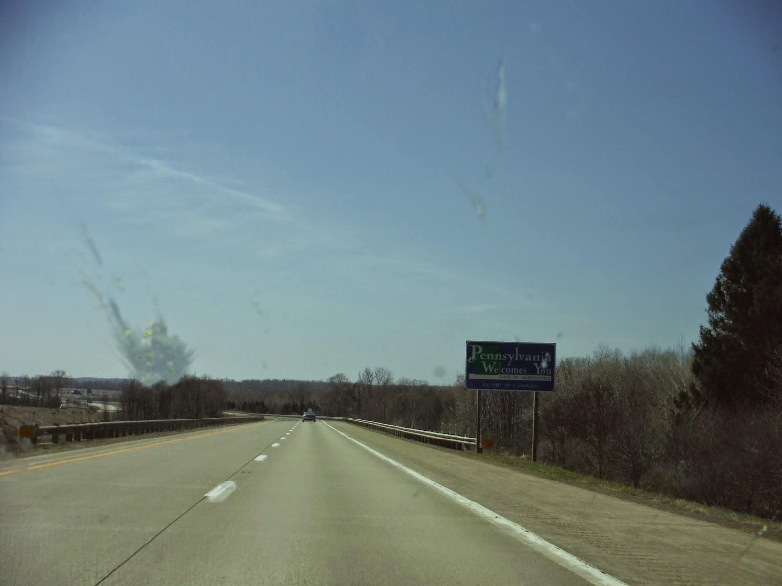
After finding the highway, the last (and endless) part of New York passed without too much drama, though I got very tired of the badly constructed concrete road sections.  I was blessed with a totally redone section to guide me into the great state of Pennsylvania.  As you can see on the left of the picture below, my windshield became an overpopulated graveyard for bugs.  SO MANY BUGS.  And they don't scrub off easily.  They persist even when dead.

Welcome to PA.  And a bug.  Or what used to be a bug.

I like to try doing something outside in each state I visit, but I was only in PA for 50 miles, so I didn't do much aside from opening the window.  My GPS told me there was a chance I might make it for 5pm, and I could hope that the game would still be in progress.  I'll tell you most of the rest of the day looked an awful lot like the above picture, but imagine about 50 more cars per lane in front of me once I hit Cleveland.

I arrived in Oberlin, very excited to stand up after 560 miles sitting, albeit in various positions.  Below is the map of my progress for this leg of the journey.  Total miles covered is now up to 1062!


Ultimate was so fun I didn't even get any pictures.  Then again, who wants to see a picture of a bunch of sweaty college students?

The day came to a close with a wonderful dinner cooked by Josie.  We had authentic chicken parmesan with alternative pasta and broccoli. There's nothing like having a home cooked meal after a long day.  I was taught to play a ridiculously stressful card game called Golf that evening. Like the real game of golf, you are aiming to end up with the fewest points, yet actually knowing which cards you have is controlled by very strict rules.  As usual, Colin won.

This post was on the longer side, so I will save my outings whilst in Ohio for Part IV of the trip.  Enjoy!

Thursday, April 16, 2015

2015 Road Trip: Part 2 (VT-NY)

Vermont to New York
Day 3
4.16.15 - 4.17.15

Thursday began with yet another beautiful day with warming temperatures and a clear sky.  Today my goal was to drive in some convoluted fashion to Schenectady, NY to see some friends from Union College.  As per my usual incessant planning, I checked google maps again to see how long it would take, and the result was around 3.5 hours.  But that was the fastest route, and I could have used a feature for "most beautiful route".  The route I ended up taking certainly took much longer than 3.5 hours, but completely worth it, as the Vermontian countryside is one of the better things in the world.

I took a leisurely start to the day, and pulled out the paper maps to figure out what roads might be fun to check out.  This is the joy of being on a solo road trip.  You can open up a map, say "I want to go here," and just do it without any worry that you won't get back in time, or that it's in the wrong direction.  I admit, a GPS is great for getting to a destination, but when you want to experience a journey, paper maps is where it's at!

With my start point of Waterbury, VT nestled up in the northern Green Mountains, I was interested in following the whole range south and then crossing over into New York later rather than sooner.  I have no regrets. I chose Rt. 100 to start with, and let me tell you, there's nothing quite like driving alongside the bumpy Green Mountains for miles and miles, where every bend in the road gives you a new mountain to look at.

Rt. 100 was going great and all, but then spontaneity got the best of me, and I went westward to cross over the mountains via Rt. 17.  I passed by a ski area, started racking up the hairpin turns as I gained elevation to Appalachian Gap at 2375'.

Appalachian Gap, Rt. 17
The descent was just as beautiful, just seeing the mountains pass by you as you carve the corners into the valley.  It's always handy to have effective brakes in the situation.  Having crossed the mountains, I was now on the western side, I suppose in the Lake Champlain valley...I'm not sure if that's official or not.  I passed by lots of farmland and some little towns as I made my way south.  A pleasant place to drive through.

Rt. 116
Eventually temptation took over once again, and I saw a sign for Rt. 125, Scenic Byway, which - you guessed it - crosses to the other side of the Green Mountains.  This road, however, followed a stream of sorts instead of gaining lots of elevation, but that was equally enjoyable.  It seemed like a road you'd see in a national park (this is probably because it's in a national forest).  Your feet get a good workout along this route with all the curves and hills.

Rt. 125, Scenic Byway
Because of my late start, I was beginning to crave some lunch.  So here began the search for a picnic area.  I had rejoined with Rt. 100 again now that I was back on the east side of the mountains.  I spotted a small picnic area by a stream to have some lunch.  It was beautifully located by a hayfield that hugged the hills, and a farmhouse on the opposite side of the water.  I had the place to myself, made some lunch, and walked along a small trail that followed the stream to a rocky beach a ways down.  This was my opportunity to stretch the legs, since there isn't much variation in driving positions.  The legs were happy.

The field by my picnic spot!
The White River

After lunch, I continued along Rt. 100 southbound, which does eventually go the length of the state.  There was not a shortage of mountains along the route, nor ski areas.  I passed Killington, and quite a few others whose names I didn't pay much attention to.  At some point I saw this cool bridge and had to take a picture of it:


My journey along Rt. 100 finally ended in Wilmington, where I began to cross the mountains for a third time along Rt. 9.  I have been on this road a few times commuting to and from Union College, when I thought the standard highway route was too boring.  I have to say that by this point, even I was a bit sick of driving, and I tend to enjoy it.  I think I was about 5 hours in, and when it's all state roads, I just wanted to sit back and set the cruise control.  That doesn't work well on state roads.

After crossing into New York, my fourth state on the trip, I discovered I had timed my arrival into the Capital District (Albany/Schenectady) perfectly for rush hour.  Apparently I don't drive aggressively enough for New York, based on some of the stuff I observed in my rear view mirror. However, I did make a successful arrival into Union College, after 10 months of absence.  I know there were things about college there that I didn't like so much, but getting to see the people I met at college was refreshing.  Kicked back, did a bit of gaming, and got my signature chicken parmesan sandwich from the dining hall, and then nostalgia arrived at the party.

Here is the map of my progress along the trip.  I completed 237 miles, bringing my total to just under 500 miles.


Normally I have a heading for each day, but Day 4 was pretty low key, and I spent it doing some route planning for the next few days, and trying to get all the old roommates together for dinner.  Over the course of lunch and dinner, I was able to see everyone at least once, which was great.  The great part about doing this trip, is that whenever I go to visit someone, I get to share my story of the trip so far, and it only gets more interesting as the trip gets longer.  I also determined from seeing glimpses of some engineering textbooks from my sophomore roommate, Benny, that I am extremely glad to have made an alternative plan for this year.  I'd much rather be seeing the world go by me right now, hence the trip.  Cheers!

Tuesday, April 14, 2015

2015 Road Trip: Part 1 (ME-VT)

Maine to Vermont
Day 1
4.14.15

I do think it's time to finally write an update on my road trip.  I've been debating on how to determine my posting interval, hence the delay. What I've decided to do is post every time I make it to a new location.

Despite a cold and rainy start to the first day, the rest of the trip has been filled with sunny days and quite warm temperatures.  I've learned that it seems very easy to pack for a road trip until you actually start trying to put a pile together of everything you need.  Then you realize it's an overwhelming ordeal that involved a fair amount of last minute shopping, and lots of lists and double checking and ultimately forgetting a few things you wish you had.  Like a spreading knife and my banana bread recipe.  Not horrible in the grand scheme of things, because I can find both of those things pretty easily along the way.

Here's me at my Gramcat's house.
It felt very strange just arbitrarily pulling out of the driveway to start such a trip.  The first hour or so I was distracted by the squeaking of my two styrofoam coolers for food every time I turned around a corner, as well as the driving dynamics being quite different with the entire back filled with equipment, supplies, food, water, hiking and camping gear, and god knows what else.  This uneasiness settled as I got into the groove, following the back roads to southwestern Maine.  I am on a mission to avoid toll charges if possible, and there are several benefits to this. One, you save money, and two, the alternative route often takes you through beautiful parts of the country that you wouldn't otherwise see if you were blundering down the highway for a few hundred miles.

After awhile, the dreary wetness of the rain from the night before had evaporated off and left a nearly clear day behind.  This greatly improved my mood, and I was able to sit back and enjoy the fact that I was driving somewhere purely because I enjoy doing so.  Not often have I had this opportunity - driving for enjoyment, not as a means to point B on the map.

For those of you reading that enjoy finding fun roads to drive, let me share what I found.  Route 11 in Maine is the second longest road in maine, just behind US-1, and I found myself on 11 for some time in western Maine just north of Sebago Lake.  This road is one of the more winding ones in the state that I know of.  Perhaps I was lucky, but I got it nearly to myself with no traffic or potholes to worry about.

Below in a picture of Pleasant Mountain, which appears to be a ski area according to my super detailed analysis of seeing white patches down the side of it.  It looked to be an attractive hiking option, since my original plan of hiking Mt. Chocorua in New Hampshire was looking to be a bit long for the time I had available.  Out came the atlas, and I discovered there was a tower on top.  I am a sucker for towers, so I had to check it out.  I packed a lunch, ice cleats, gaiters, and some water, and headed up the trail.  This was the fire warden trail, so in theory it's the most direct.  It didn't feel like it, but that is probably because I am out of shape.  Very icy, and I was too stubborn to put on the cleats or the gaiters, so I was slipping and getting snow inside my shoes.


Pleasant Mountain from SR-302
I did make it to the top, bushwhacking a few times to avoid some deep puddles from the meltwater along the trail.  It was extremely windy on top.  You see me in the next picture in a teeshirt, but it didn't last long.  I decided to climb the tower to improve the already fantastic views in all directions.

Whoops - I missed the summit sign.  It says 2006 ft.
Compared to one of my favorite towers in the state, the Old Speck Mountain tower, this was considerably larger, but with one drawback. The cabin was locked, so I was stuck to huddling right under in and taking pictures.  Or from my perspective, trying not to fall off from the gale winds up there.

Fire tower!
But just look at this photo of the Presidential Range in the Whites of New Hampshire.  Totally worth coming up top!

Mount Washington is the just in the clouds.
Mothers beware; view at your own risk.  This is the view down from the top of the tower.  I was very excited to get back down.  I don't usually get scared climbing towers, but with this much wind, I was quite nervous, so I carefully came down to Earth for my lunch, which luckily didn't blow away.


My next goal along the trip was to drive the Kancamagus Highway in New Hampshire.  I had been told that this is the state's best, most windiest (twisty, not blowy) roads.  It was good, but not quite as good as I expected.  What I didn't realize is it goes up to Kancamagus Pass at 2855 feet.  I stopped at a few pull-offs for pictures, since they are better if you don't take them through the car windows.  The tallest one in the picture below is Green's Cliff, 2926', 2 miles away.  I know this thanks to the panel that explained what I was looking at.  The road seemed a lot like the Loop Road in Acadia National Park, which is nice, but I feel like you're being forced to stop and see the things that the park thinks is cool, and not necessarily what I think is cool.

Left to right: Greens Cliff - 2926', Mt. Tremont - 3784', Owl Cliff - 2951'. 
I did enjoy the descent after Kanc Pass, though with a 9% grade, it's very easy to pick up a bit too much speed.  Brakes were effective. Modern technology these days - it has revolutionized everything.

Not sure exactly which mountains, but I think they might be the Tripyramids?
Feel free to comment if you know - this was just before the hairpin turn on the Kanc.
From here to the end of the day, I didn't take any photos because I was trying to make my way to Waterbury, VT, where Jules, a graduated Watershedian lives with her partner Nick.  All three of us have worked in Baxter State Park as trail crew interns, so I was excited to share my experience from last fall working there with them.

I passed so many ski areas on the final leg of the trip along the Kanc Highway and SR302 through Vermont.  I also passed many, many Subaru Outbacks.  The rumor is true about everyone driving one of those in Vermont.  I tried to blend in with mine, but I bet they noticed the Maine plates.

It turns out that Tuesday was Ben and Jerry's free cone day, and with Waterbury being the location of the factory, we had to go.  The line was excessively long, but I think well worth the wait.  We came back and had some delicious homemade pizzas, and I made some plans to hike Camels Hump the next day.  Camels Hump, at 4083', is one of the five 4000 footers in Vermont.  It is only a few miles away, so that was convenient.  This would also be my first time hiking in the state of Vermont.

For those interested in the maps, I've recreated my route in Google maps.


Camels Hump
Day 2
4.15.15

Wednesday brought with it another sunny day, perfect for hiking and getting sunburnt!  I was too optimistic about the suns rays being oblique enough to not worry about sunburn.  I was wrong.  Nevertheless, it was a nice muddy drive down the Camels Hump Road to the winter lot, which added a bit of mileage onto the hike, but that's no biggie.  As I ascended, I encountered two hikers coming down with snowshoes, and I was without them.  It was recommended that I get mine from the car, so down I went.  There was a bit of semi-packed snow, but it turns out higher up on the mountain, it wouldn't have been pretty breaking trail through 3-4 feet of snow without snowshoes.

I discovered one of the trails was called Monroe Trail, and being from Monroe, ME, I had no choice but to take that one.  You can see it on the map below on the east side of the mountain.

Camels Hump trail map.
I had to deal with a few false summits, one of which you can see below. This massive rocky headwall was the second to last one, if I remember correctly.  I can't imagine how boring this hike would be until the very end if you did it in the summer, because all the leaves would cover up your views.  This time of year, you can see the mountains behind you as you climb, as well as what's in front of you.  I love to be able to see my destination when hiking.


So this is a weird panorama, but this is the final "hump" of the mountain, and it was completely barren of snow, unlike the Alpine Trail cutoff, which I took to come up the south side of the hump as opposed to the north.  The Alpine Trail didn't appear to have had any traffic for quite a while, though I saw some evidence of snowshoes every so often.  This joins up with the Long Trail  (which spans the length of Vermont) right before the summit.  I left the snowshoes at the base of the hump and went up in just my shoes.

The top of Camels Hump.
Where I took the panorama, the sun was beating down on the rocks, it was warm and toasty, and on the leeward side of the mountain.  Not so once I got on the top.  I was very cold, and regretting not stuffing mittens in my pack.  However, this view made up for all of that.  The Green Mountains is a special place because you have views of the White Mountains to the east, and also views of the Adirondacks to the west. And of course the Green Mountains are around you to the north and south.  It's a beautiful place, and I hadn't considered the views of the other ranges that you get when coming here.

Presidentials from the western side this time.
Probably just a glimpse of Maine as well.
The view north toward Mt. Mansfield, another VT 4000er.
Okay, I need to get this off my chest.  WHY aren't there summit signs in other states??  In Maine, you get a nice sign telling you that you've made it to the top, and the elevation is listed.  Every other state I've hiked in (NH, VT, and NY) there are no signs.  It's pretty obvious once you get to the top in good conditions, but I've been across Franconia Ridge in NH and it was very wintery, in the clouds, and I couldn't see a thing except a few feet in front of me.  I have no idea where Mt. Lincoln is.  I must have passed it somewhere, but it was not clear at all its whereabouts.  Anyway, have a sign-less summit photo of me on Camels Hump!

My first hike in Vermont, a success!
I found a spot down from the top to have some lunch.
Well deserved, and delicious.
Aside from a spot near the top of the snowy bit that I had to snowshoe down backwards due to the steepness, it was a very quick and uneventful descent.  I had broken trail, so my tracks helped a bit to stop me from sinking in too far.  My snowshoes have cleats only under the foot straps, so if you lift the front up a bit as I walk down hill, there is a lot of sliding to be done. :)

A final sunset near the bottom of the trail.
With some time to spare before darkness, I went to explore (read "pretend like I live here") some of the other dirt roads off of Camels Hump Road.  People LIVE out there.  I didn't expect that.  But they all drive Subarus, and they have some sweet views of the Green Mountains, like this one here:


You can see the final hump that I photographed earlier from this perspective.  It's lumpy as far as mountains go.  I'll have to come back some time to hike it again, or perhaps try out another one.  For now, I'll just send out a thank you to Jules and Nick for letting me crash at their place for a few nights.  My experience of the Green Mountain area was fantastic, and I intend to come back again.