Thursday, October 22, 2015

Elliotsville Plt. Excursion: Barren Mountain Overnight (Brrr!)

Having spotted evidence of a tower on the summit of Barren Mountain, my interest was piqued.  After my walk out to Little Wilson Falls Gorge, I was ready for another hike.  I had planned (barely) for an overnight somewhere out in this area.  I wanted to test out more thoroughly my new overnight pack I purchased from REI along my Road Trip this spring.  Without any definite plans, headed toward Barren since I knew I could at least climb Barren that afternoon/evening, and maybe go further if I was interested.

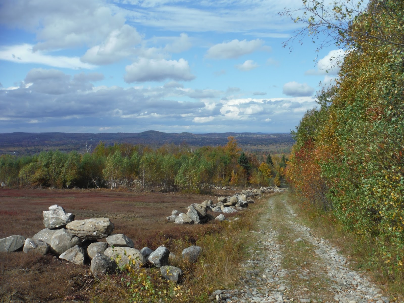
I returned to the Borestone trailhead, and continuing past that on Mountain Road (which turns dirt after the parking area), I ended up in a field, pictured below.

Barren Mountain from a field
Looking at the map below, you continue through the field, through a gate (which was open) and over a bridge.  From there, drive 0.5 miles and you'll see a gravel road to the left.  This will lead to a parking area after an additional 0.7 miles.  You can't really drive much farther anyway, so this is where I parked.

Access map
From the parking area, I packed my stuff, and prepared myself for a heavier pack than I normally carry.  I may be good at day-hiking, but within minutes, I realized that I am not at all used to carrying around overnight gear with me.  The panting began.

The trail begins as an access trail for the AT, roughly three tenths of a mile long.  It is quite wet this time of year.  I tried and failed to keep my feet dry.  The trail dries up with elevation gain, and there is a pink flag where the trail joins the AT.  (This is especially helpful when returning back to the access trail.)

From here, the trail ascends steeply.  After about 1.6 miles, there's a small spur trail to the Barren Slide, which was prominent in the photo from the field.  I had beautiful evening lighting, looking off to the mountains to the west.


Walking down a bit onto the boulders that make up the top of the slide, you are reminded of all the shale in this area.  Sharp edges are everywhere, since shale is constructed in planes and will often break along those planes.


Here is Borestone and Lake Onawa from the Barren Slide:


After this overlook, the trail is mostly flat, and makes for some easy going.  It's about the same distance from the parking area to the slide as it is from the slide to the summit.  The last portion of the trail prior to the summit is unexpectedly steep, though nice rock steps are in place to make it a bit easier.  I did see one patch of ice about one foot square, so this is evidence that winter had dipped its toes around this area already.

I spotted a glimpse of the old fire tower through the trees, and I knew I was just about there.  I was hoping to catch a sunset from the top of the mountain, and the way things were going, I was going to be just in time for it.

Looking to the north, the Second Narrows is visible in the valley, and various mountains past that, including West Peak, Big and Little Spruce Mountain, and White Cap Mountain if I'm not mistaken.


Using the tower as my tripod (I sure am resourceful), I got to photograph one beautiful sunset from a mountaintop.  I have never done this before because I usually try to be off the mountains before sundown.  But with overnight gear at my disposal, this was now an opportunity for me!  I decided to camp up at the top since that was convenient, and I was a bit wiped from carrying more than I'm used to.

Sunset from Barren Mountain
I had a hot dinner with my $7 stove from Amazon (yay bargains!) consisting of instant potatoes and ham.  Oh, and chocolate.  Lots of chocolate.  There is just barely enough room for a one-person tent up there just beside the old roof to the cabin that used to sit on the tower.  And mister smarts here accidentally put the head end of the tent downhill.

Despite all complications, I was able to stay warm with fuzzy socks, hats, mittens, and a 20° sleeping bag.  Except for my nose.  The moon gave off some light through the early part of the night, but I was awoken by pattering on the tent around 11pm.  Here was that forecasted rain...

I didn't sleep great that night, mostly because of waking up so much.  But I got many more hours than usual, so if that counts, I count it.  The wind was very blowy in the morning, and I was not looking forward to packing up in such wind, so I applied all layers in inventory, and made a break for the outdoors.  I skipped official breakfast due to wind (not good stove conditions) and ate chocolate and saved the gritty stuff for later on.

For some reason, I missed the sign for Barren Ledges on the way up, but I saw it on the way down, and it was pretty cool.  The clouds were high enough to have Borestone visible to the south.


The rain had stopped for the most part while I was hiking down, despite the forecast saying it was supposed to rain most of the day.  I got some sprinkles toward the bottom, but I was plenty warm by that time, so no worries of hypothermia.

Borestone from Barren Ledges
The trees in the fall colors under diffuse overcast light made for an interesting hike down.  It seemed as though the trees made the forest brighter...an odd concept at best.


Going down is really nice, but going down slowly is even better.  With an early start, I got down with plenty of day to start.  Below is the Google Earth track and elevation profile.


Hike Data
Miles hiked: 7.0
Time elapsed: 3.4 hours
Total ascent: 2430'

On my way south, I stopped at a neat bridge I had seen on the way up, but I was slightly rushed for time because of a late start.  I always like a cool bridge.

A cool bridge between Elliotsville Plt. and Willimantic
Stay tuned for the last part of the Elliotsville Excursion!

Wednesday, October 21, 2015

Elliotsville Plt. Excursion: Little Wilson Falls Gorge

I'm a sucker for the "Unique Natural Features" in Delorme's Maine atlas, and there's a few of these places scattered up around Borestone, one of which is Little Wilson Falls Gorge.  It is right along the AT, and it has a mile-long access trail that is marked on some maps, but not on Delorme's atlas.  From the bridge over Big Wilson Falls, there is a bumpy road called Campground Rd. that goes up to the northwest roughly one mile.  There is a beautiful picnic area at the end of the road, with a few short drops in the Wilson Stream that make for a pleasant place to stop by for lunch if one were so inclined.

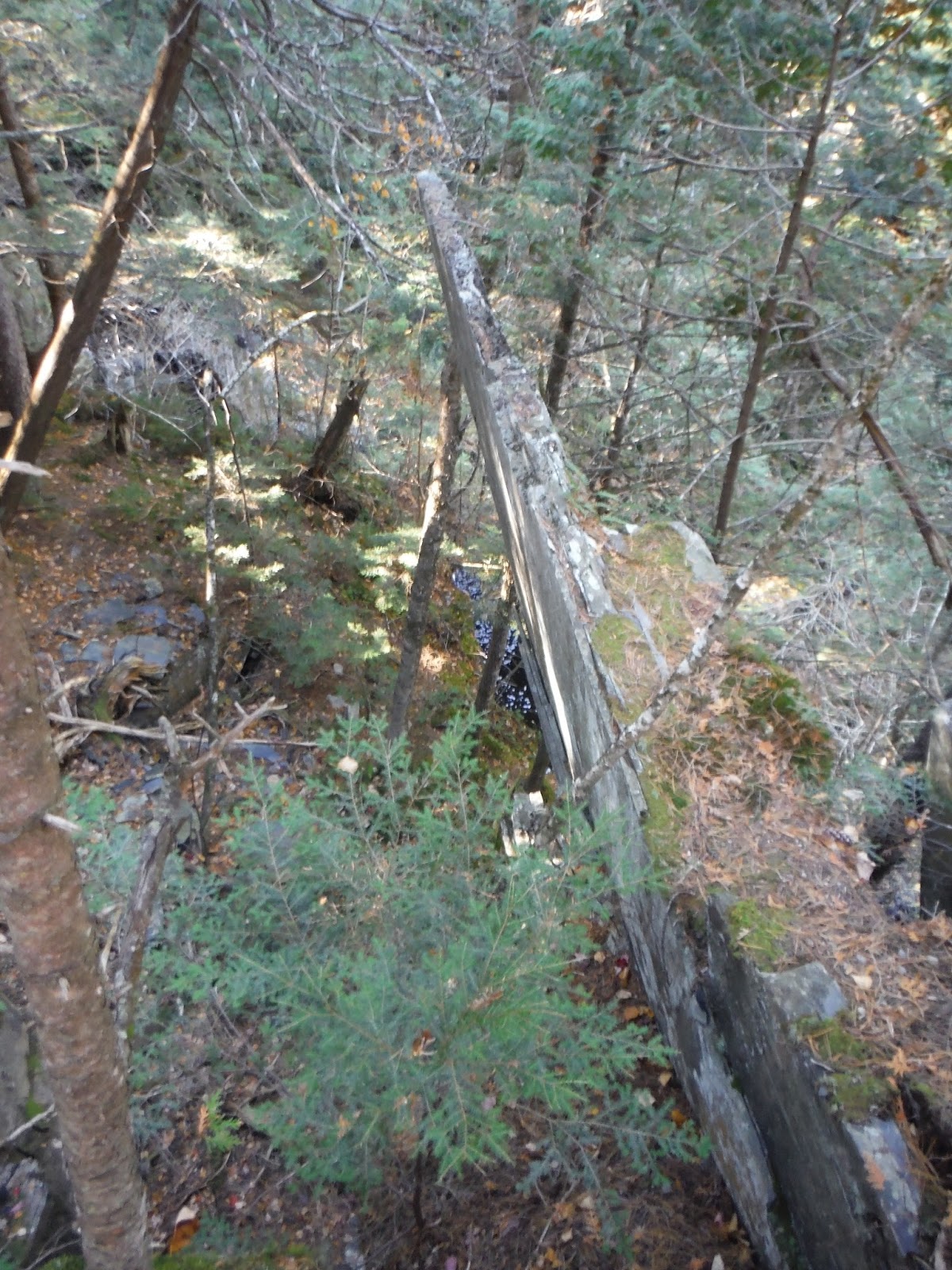
Instead, I followed the path upstream marked with blue flags (and later pink and orange ones).  This is a gentle walk through the forest, with the stream audible to the right for nearly the whole way.  After joining up with the AT, I came across the most odd piece of rock I've ever seen.  It was a slab about four inches thick and probably a good 12 feet tall, jutting out of the ravine almost vertically.

Slab from the left
Of course I had to go and walk out on it a bit.  Here is the right side of this crazy rock.


I walked around past it a little to get a better side view of it.  How it's still in place in such an  obscure position is a mystery, but I thought this was a super cool surprise to see along the trail.


A few hundred yards after the strange rock, you can start to hear the falls.  You approach from the top, so it's not apparently quite how large of a waterfall this is at first glance.


I peered down into the gorge, and I swear it's a scene straight out of Minecraft.  All the rock is shale around here, and it's comprised of layers that have broken off in square chunks almost exclusively.  This made for an easy walk down into the depths of the gorge.  Just watch out for the wet spots, because falling in here would mean certain death!

Down into the gorge
From the base, you are able to look back up the opposite side, also composed of these thin layers of shale.


After debating for far too long which way to orient the panorama, I present a horizontal one of the falls from top to bottom.  The atlas says the falls are about 40 feet tall, and that seems about right to me.  Not a terribly large stream, but it makes a roar as it plummets down this drop.


This really wasn't too much of a hike, but I'll include the data for your entertainment anyway.

Google Earth track and elevation profile
I started on the right, where the Campground Road ends, and traced my steps back to the start.  (There was a sign for no camping, which seemed odd considering the road's name....but I suppose I'm not one to assume.)

Hike Data
Miles hiked: 2.5
Time elapsed: 1.3 hours
Total ascent: 530'

Elliotsville Plt. Excursion: Borestone Mountain

It was recommended that I check out Borestone Mountain by a Karen, one of my coworkers at EBS.  First off, I was excited to hear of a new place in Maine I hadn't been to or even read about somewhere previously.  A quick check in the Maine atlas brought to my attention a few more interesting places nearby that I could likely explore over the course of a two-day weekend...

So Borestone is a sub-2000 foot mountain in the Elliotsville Plantation, and perhaps because of its relative shortness compared to the famous 4000-footers like Katahdin, Bigelow, Sugarloaf, and Old Speck, it is often overlooked as a hiking destination.  It was by me at least.  But it shouldn't be, because it's a great (and pretty challenging) hike with nice vistas and well built trails.  Also, I should make known the presence of the three small ponds halfway up the mountain, or tarns, as I should be calling them: Sunrise, Midday, and Sunset Ponds.

Here is a view of Borestone from Barren Mountain to the north.  The eastern face of Borestone is craggy and steep, giving the impression of a high perspective over the valley.  This is especially nice with a partially bald summit.

Borestone Mountain
To access the parking area, you're going to be coming up the Mountain Road from Willimantic or Elliotsville Road from Monson, and right past the bridge over Big Wilson Falls, you drive up the east side of the stream on Mountain Road and the parking area is after the train tracks on the left.  The trail begins on the right side of the road and doesn't hesitate to begin climbing almost immediately with lots of shale steps built into the hillside.

You can either walk up the road or take the trail, since they meet up at the ponds, where I believe you can rent some rooms in a lodge.  I took the trail, which winds a bit more uphill through the forest.  I stopped halfway to the ponds at an overlook on a side trail which crosses the road downhill a short distance.

Trail network from mainetrailfinder.com
The photo below is just before the trail meets up with the road again.  The fall colors up here, albeit on the ground a fair amount, were still nice (and crunchy - good if you like your colors crunchy).


I continued past Sunrise Pond to the east where the trail soon began its very steep section of steps up to the summit.  The pond is just visible through the trees as you gain elevation, but soon you find yourself focusing on how such a small mountain can be so challenging.  The trail comes to a big rocky outcropping that is steep and includes iron rungs for assistance (or possibly entertainment as well).  Once out of the trees, you can almost see all around you, with Barren Mountain taking up much of the view to the north.  Big Moose Mountain (shown below) is the biggest mountain to the east.

Big Moose Mountain over Borestone
I found myself on the westernmost of Borestone's double peak, and sat for awhile facing each direction.  I'm amazed to say that every view was nice, and had something interesting to look at.  This is a great hike to bring binocs.

Big Moose Mountain from the west summit
The view north includes Onawa Lake and Barren Mountain (2650').  This time of year, I love being able to see the distinct difference between the deciduous and coniferous trees.  You can tell in the summer with the different shades of green, but nothing beats green and bright orange.

Barren Mountain over Onawa Lake
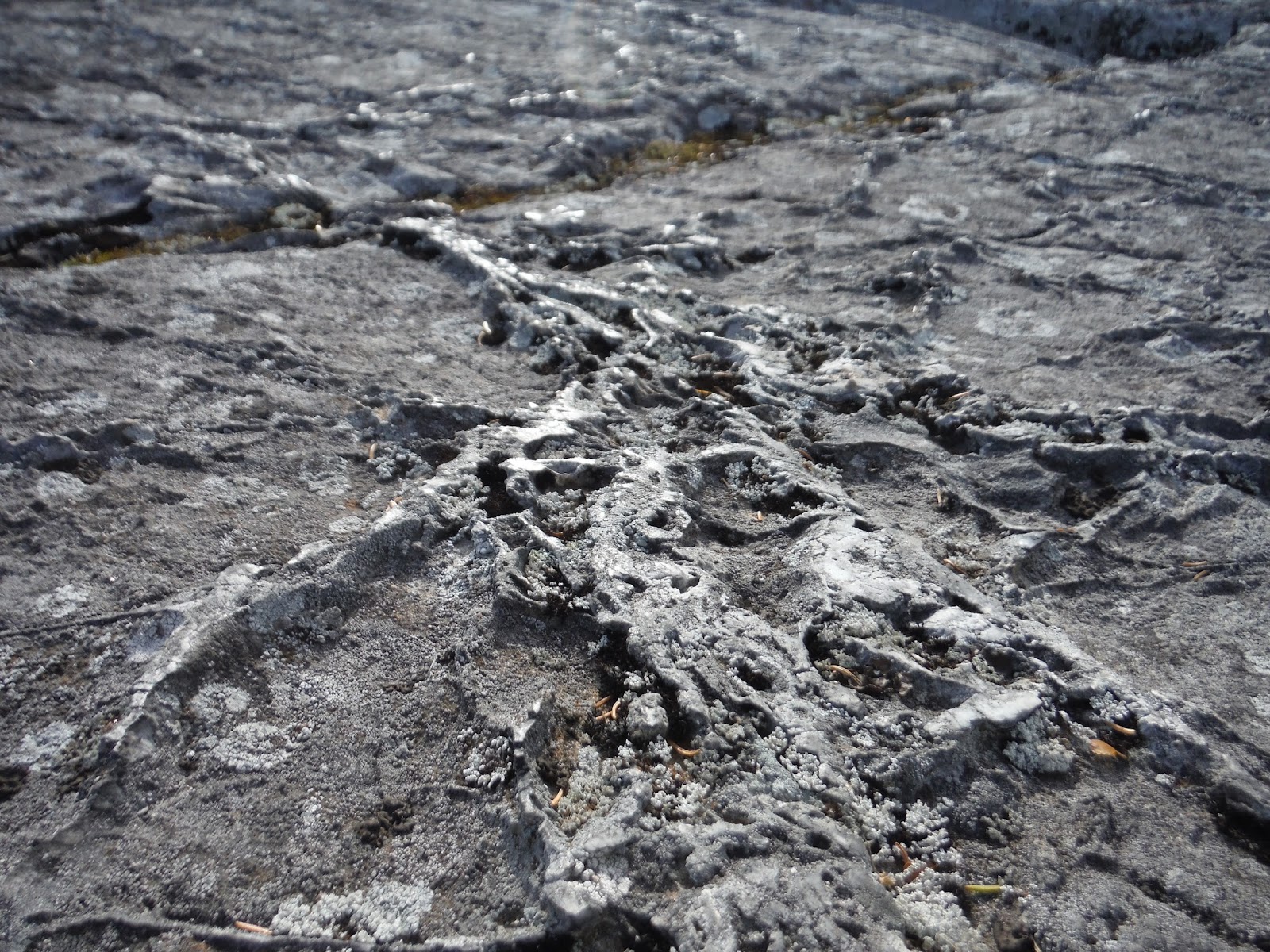
I took a jaunt over to the eastern peak, which was advertised as "highly recommended" on the website for Borestone.  The trail drops into the forest briefly, and then back up onto ledge again.  Around here, the ledge is really odd.  Close up, it looks like there are seams of some harder rock surrounded by a soft rock that was either eroded or scraped away via glacier.

The rocks on the eastern peak
There is a map mounted on this peak, which was great for identifying what I was seeing in every direction.  It had an aerial view in the center of the map, as well as a perspective view along the edge that shows the mountains as they appear from that viewpoint.  I noticed the strangest mountain that looked like a double M, or maybe like "Mm".  It is visible as the furthest tier of mountains in the photo below. It turns out this is Mt. Bigelow, a mountain I climbed with my friend Gugen in the summer of 2014.  The two higher bumps are Avery and West Peak, and the lower bumps are the two Horns on the west side of the ridge.

The view southwest, Bigelow in the distance
I saw some really interesting rock patterns on this hike as well.  I say they take the medal from Tumbledown's wiggly scrapes from last week.  Not sure if this is layered rock that got smushed, or glacier scrapes, but either way, it was pretty awesome. And it adds traction on those steep faces, so you don't get scrapes like this on your face when you fall. :)


Below is my Google Earth track and elevation profile.  You can see the trail down to the overlook, which I took on the way up but not on the way down.


Hike Data:
Miles hiked: 3.8
Time elapsed: 2 hours
Total ascent: 1650'

Thursday, October 15, 2015

Tumbledown Mtn. via Loop and Brook Trails

With fall colors fully in bloom this week, I thought that Tumbledown Mountain would be a good place to see it all.  I couldn't have picked a better spot!  It was a terrific hike filled with all colors of the rainbow.

Tumbledown is perhaps an easily overlooked mountain in Maine.  At least to those seeking out the 4000 footers.  Tumbledown stands at just 3068 feet, with Little Jackson behind it to the northeast at 3434'.  However, despite being shorter than 4000 feet, the southern face is dramatic with steep rocky cliffs that drop into the valley below.  Here is a map I pulled from an online database of USGS quads here.

Tumbledown Mountain
My plan was to hike up the Loop Trail, which is the quickest way to the summit and is known for a tight section called Fat Man's Misery.  From there, I would head east to Tumbledown Pond, head back down the Brook Trail, and do a road walk back to the Loop Trailhead where I had parked.

The Loop Trail began as a gentle meandering squiggle through the forest.  Not far in, I came upon one of the largest erratics I've seen hiking to date.  The only one that matches this in size is one I saw coming down from Mt. Bigelow via the Horns Pond Trail.  (Disclaimer: I am not great at estimation.)  I estimate that this erratic was on the order of 20-30 feet tall, and a good 100 feet around.

A large erratic on the trail.
This was the beginning of the answer to why the mountain is called Tumbledown. This trail looked like a giant on top of the mountain was just tossing down massive boulders into a big pile.

Underneath the big erratic
A steep section following the large erratic gave way to a few openings in the trees where I was really able to see the upward progress that my legs were noticing.


I broke through the trees and got onto some open ledge, where I was presented with a view of my target.  Truly a surprising cliff face after such a steep climb already.  I could have been fooled into thinking this was a much larger mountain.

Tumbledown in sight
I walked along the open ridge for awhile before ducking into the trees once more to ascend into the col between the two humps you see in the picture above.  Looking west, I was able to see many tiers of hills, perhaps as far as New Hampshire.

Blue hills
Looking up, scraggly trees and pointed firs poked into my bluebird sky I had.  (Did I mention I felt very lucky to not be rained on for once!)


I approached Fat Man's Misery, where I was instructed via blue blazes to enter underneath a large rock into the darkness.  I squeezed in and this was my view out into the valley:


And looking up.

Iron rungs to help out
The opening on top was about a 2 foot square, which I nearly didn't make it through with my pack on.  However, after crawling through and up a few hundred feet more, I was rewarded with a full color palette of fall-time in the valley.


To the right of this panorama, you can see the steep front face of Tumbledown, and why the trail didn't go directly up that.  I think it was steep enough as is if I'm honest.


It was a relatively quick hike from the col up to the summit.  I met a couple from Lincolnville at the top, who were returning after 40 years I believe they said.  I always enjoy meeting people that are from somewhere nearby.  I say we all picked a good day to be out in the hills.  The colors don't get much more vibrant than this. Looking to the southeast from the summit is Webb Lake, which sits below the town of Weld.


Somebody painted a smiley on top
As I headed to the pond, I saw many instances of what I assume to be glacier-scraped granite.  Very interesting patterns compared to what I normally see out on the trails.


The pond came into view once I crested the hill past the Loop Trail junction.  Very different from my winter view in January, when everything was icy and snow-covered.

Tumbledown Pond
Little Jackson from Tumbledown Pond
The Brook Trail is supposed to be much easier to go down, and once I passed a boulder field for a few tenths of a mile, the trail transformed into the wide carriage path, albeit rocky.  I was surrounded by birches and aspens glowing a bright yellow with their fall foliage.

Brook Trail
As you might guess, this trail crosses and follows the brook for a few miles as it leads back to the Weld to Byron Road.  Again, let me emphasize how gentle the descent is.  My knees were extremely happy with this choice of trail on the way down.

Unfortunately, I had a road walk ahead of me to get back to the parking area, but at least it was a picturesque road walk this time of year.

Weld to Byron Road
As per my usual, I've got a Google Earth track and elevation profile for you!  I went clockwise (up on the left, down on the right) and it appears to be a 5.75 mile hike including the road walk back.  It may be a little longer if you account for every twist in the trail, but I'll go with 5.75 miles.

Google Earth track and elevation profile
Hike Data
Miles hiked: 5.75
Time elapsed: 3.6 hours
Total ascent: 2343'

I hope to return to Tumbledown again, in any season, because I've learned than all seasons offer something special on a hike in the mountains.  Just make sure you're prepared with the proper gear or things might go badly.

I have a surprise for all of you for next week's adventure...

Wednesday, October 14, 2015

Mt. Waldo in Autumn

Today I took a quick jaunt over to Mt. Waldo in Frankfort to see the fall colors from an elevated perspective.  It's a nice hike because it's close and I can see the top from my house.  Today I brought binoculars in hopes of being able to see my house from the top.

I started on Tyler Lane, where I believe the service "road" begins.  This was the route that I saw a service van descending once at least.  It begins quite easy, even for a vehicle, but soon becomes rocky, as you can see in the picture below.  This is looking back along the trail, with blueberry fields off to the left.


The leaves on some trees seem to have turned before others, and this one was in peak color.  The benefit of having some trees turn earlier than others is that the season lasts a bit longer.  It has been interesting noting how much later the color is this year compared to last year.  Since I was working out in the woods of Baxter SP last September and October, I was quite aware of the timing of the fall foliage, and it is a few weeks later this year, if not maybe a whole month.

Bright red autumn leaves
The trail/road that goes up to the top of Waldo is nearly a straight line.  It follows the power lines up to the radio towers on top, and because of this, you can see the trail up for the whole way.

Once I got to the bald top, I was able to see all around from Camden Hills area, with Swan Lake in the foreground.

Swan Lake
As ugly as the towers can be on top, it is kinda neat to get right under them and look up.  Today there were some interesting clouds as a backdrop for it all.


I walked around a small loop on top and headed back to the northern side of the mountain where I had ascended, looking for a good place to search out my house in the maze of trees, fields, and buildings.  I know my house is next to the high voltage power lines, so that was helpful.  I've put a small red arrow pointing to my house so you can see it better.  Always nice to be able to see things from both perspectives.  I see Mt. Waldo every day at my house, so it's nice to finally look back.

My house!
Below is a zoomed out shot in the same direction.  I do love the opportunity to hike frequently during this time of year.  It's a fairly new experience for me because so far, I have been in school in the fall with the exception of last year when I was immersed in the fall colors at Baxter.


As we get into the peak of fall-time, I am looking forward to the start of the winter hiking season.  Who knows how early snow will come this year, but finally after a few years of learning about what kind of gear I need for four-season hiking, I am ready for anything now!

EDIT:

Here is the Google contribution to the post.

Google Earth track and elevation profile
Hike Data
Miles Hiked: 2.2
Time elapsed: 50 minutes
Total ascent: 700'