My second adventure hiking in Vermont consisted of a trip to Equinox Mountain, a peak in the southern Green Mountains known for its good views, being made of marble rather than granite, and also (regrettably) a toll road to the top. I have mixed feelings about roads up mountains. Nathan the hiker really hates getting to a summit and seeing a road approaching the top, however Nathan the driver very much enjoys driving up mountains. So I suppose it comes down to me feeling guilty about my own interests. Nevertheless, we embarked on the journey up to 3,840 feet above sea level. The trail takes off from Manchester, VT, which is littered with coffee shops, roundabouts, and nice old Range Rovers with numerous bumper stickers.
Because safety is ALWAYS the first concern (especially hiking with Aurora), I expressed that in our pre-hike photo.
After some time meandering up the wide rocky path known as the Blue Summit Trail, we found a stand of birches that we have seen in a photo while researching the hike. We put our own spin on the photo, using it as a frame for some portraits.
 |
| This is Aurora. Invigorated by the idea of...something |
 |
| This is Nathan. In standard position |
Following the bench fiasco, the trail narrowed to a single file width, and we passed a man coming down clothed in denim, a fine choice for 80° days if you ask me. He discussed having lost a hat further up the trail, and to leave it there on the trail as he would be back up soon to retrieve it. We (read Aurora) saw the described hat and hung it on a branch, being careful not to come in contact with it for confidentiality purposes.
After entering the third type of forest of the day, the spruce-fir mixture that usually exists over 3000 feet, we came to a sign indicating a junction. Left to the summit, and right to Lookout Rock, which we intended to use as the lunch eating location. I photobombed, because that's what I'm good at.
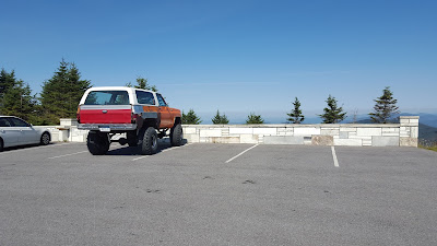
Soon after, we found the top of the mountain! The parking area was lined with some well-done marble stonework.
Atop the upper porch of the visitor center, there is a sign indicating what exactly we were looking at along the horizon.
Below, the view of Stratton Mountain, the highest mountain in the southern Green Mountains. Equinox comes in second for elevation.
 |
| Panorama, credit to Aurora and fancy phone technology |
 |
| Bronco. Ford, please bring back this model. Please. |
 |
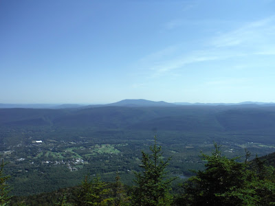
| The town of Manchester, VT |
We went out to the Lookout Rock to find a place to sit down for lunch. We ended up in a pile of sticks and moderate moss coverage because someone was using the proper lookout area. Don't get me wrong, it was a NICE pile of sticks, so it's not like we got the short straw at all. I consider it a privilege.
Before departure, we stopped again at the proper lookout to gaze at the valley once more.
The descent was pretty quick compared to the way up (as expected). There were no injuries. Congrats to Aurora for making it through another day on Earth.
Google Earth track and elevation profile are below. The mileage is always an uncertainty, but my guess is somewhere in the 6 mile range. The one-way length of the Blue Summit Trail is 3.1 miles, however we joined the trail in a short distance from the Red Gate.
 |
| Google Earth track and elevation profile |
Hike Data
Miles hiked: 6.0
Time elapsed: 5.5 hours
Total ascent: 2900'


No comments:
Post a Comment