On Thanksgiving Day, my cousin Julia and I went up to explore some nearby mountains. (This may or nay not have had something to do with a long day the day before in the White Mountains...)
Mount Waldo, a prominent mountain in the horizon from my house was our first trip, and I apologize for not taking any photos on the hike. The best I can offer is a picture of it from the other mountain we went to, Mosquito Mountain, which is just to the east.
 |
| Mt. Waldo from Mosquito Mtn. |
We went up the service route for the radio towers on top from Tyler Lane. It is the most direct route up nay mountain I've ever seen. But it was quite icy, even with as warm as it was on Thanksgiving. Micro-spikes were required for walking up some of the granite ledges near the top. Here is the elevation profile from the last time I was up, since it's the same trail.
Hike Details
Miles hiked: 2.2
Time elapsed: 1.1 hours
Total ascent: 670'
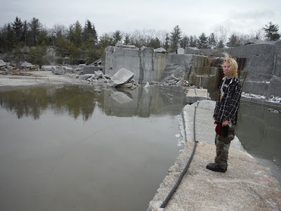
Mosquito Mountain, the next hill to the east, is known for a granite quarry, just like Mt. Waldo is. I'm not sure if there are trails up Mosquito, so we just headed up the road to the quarry. There were many blocks everywhere, and the puddles were mostly frozen.
 |
| Julia standing on ice |
A granite bridge across to the other side, where the actual summit is.
There were two bigger mountains to the east that we saw from a viewpoint that overlooked the Penobscot River and beyond. There remain unidentified, but perhaps a browsing of the atlas may reveal what they are and how to hike them.
Here is a map of Mosquito Mountain from Google Earth.
Hike Details
Miles hiked: 1.3
Time elapsed: 1 hour (including exploring of the quarry)
Total ascent: 310'


No comments:
Post a Comment