One of my bucket list items: a sunrise from Katahdin. Well this was my chance. Without getting too much into the details, let's just say I have some privileges as ex-staff at Baxter State Park, and was able to acquire access to the park at the time of night needed to start for a sunrise hike.
I brought Eliot along for his first visit to the park, which both of us were very excited about. I love to bring new people to Baxter, where I spent three months of my life in 2014 as part of the trail crew. During that time, I grew to love the park very deeply. It was a home for me, and there is a magical essence that I feel every time I come back. Long story short, I try and show to new visitors why it is such a special place. Hopefully the following pictures can help that message come across.
We began our hike from Roaring Brook campground at around 1am, with a nearly clear sky to ourselves. A rainstorm had recently passed through, compromising our confidence in a good-weather hike, but as the moon shone through the trees, hope was restored.
 |
| The trailhead, with Helon Taylor waiting for us. |
Here are several things I very much enjoyed about hiking on a night like this.
- We had the place to ourselves.
- The moon and sky are beautiful at night.
- It's cooler at night, and you don't overheat.
Upon reaching the final section of the Helon Taylor trail, the sky began to brighten with hints of sunlight. At Pamola Peak, a red-orange glow was visible, and was perhaps one of the more beautiful skies I've seen.
 |
| Pre-dawn glow from Pamola Peak |
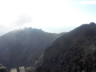
The opposite view was dark and stormy, looking across Knife Edge. We chose to continue along it since it was getting cloudy anyway, and it looked like we may miss the sunrise itself.
The Chimney is one of my favorite parts of the Knife Edge.
 |
| Eliot scaling down into the Chimney |
 |
| Katahdin Lake behind Knife Edge |
 |
| Eliot killin' it |
Slowly crawling up and across South Peak, we made it to Baxter Peak, where a large pile of rocks stands tall for all hikers.
 |
| Great view right? |
 |
| Baxter Peak at 7am |
Looking behind us, the Knife Edge became visible, showing just how gnarly a piece of rock it is.
 |
| The rocks are very square up here - perfect for lying down |
 |
| The Chimney in the background |
 |
| Index Rock and the Chimney |
Eliot was very happy on our descent along the Hamlin Ridge Trail. The sun had returned.
This was a new trail for both of us, and I admit the view from this ridge is quite amazing. You can look right into the South Basin across to Knife Edge, or to the left into the North Basin, where Blueberry Pond lives.
 |
| South Basin and Knife Edge |
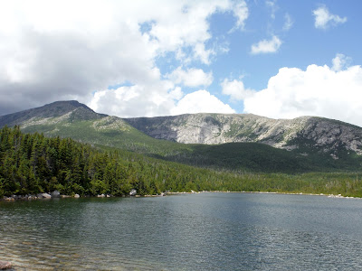
After entering the tree line, we found a small unnamed pond with crystal clear water. The northern ridge of the Katahdin massif is in the background.
We rejoined with the Chimney Pond trail, and stopped by Basin Pond to get a view of the South Basin once again before leaving.
One week during my time as BSP Trail Crew, we worked on a waterbar reconstruction on the Chimney Pond Trail, and I was pleased to see it held up so well over the winter.
After twelve hours on the mountain, we returned to the parking lot and ate many cookies! I offered to drive Eliot to the other side of the park, up to Kidney Pond, where I lived last fall for the Trail Crew operation. I saw Dean, the ranger at the campground, and he let us take out a canoe to see the surrounding mountains. From left to right: Moose Mountain, Doubletop (pointy), West Peak, OJI, Barren Mountain, and Katahdin.
Here is proof that we at least sat in a canoe.
All in all, it was another beautiful day in BSP. We left the park very tired, and ended up taking a nap at the Trading Post by Ambejejus Lake. Three hours later and fueled with caffeine, I was ready to make the trek back to Monroe.
Here is the Google Earth track and elevation profile for the hike. (We went clockwise.) Distance was 11.5 miles according to the map, though know knows....


Wow, epic Maine hike, so cool. And fun to hear the back story of your summer in the Park.
ReplyDeleteWow, epic Maine hike, so cool. And fun to hear the back story of your summer in the Park.
ReplyDelete