Showing posts with label BSP. Show all posts

Thursday, October 8, 2015

Autumn Katahdin Sunrise (and Sentinel later on)

For those impatient: yes, I finally got a sunrise viewing from the summit of Katahdin.  Something I've wanted ever since working there on trail crew in 2014.  I tried earlier this year with my buddy Eliot, but unfortunately, we got covered in clouds along the Knife edge headed to Baxter Peak.

With sunrise scheduled for 6:46am, I estimated about 3 hours to get to the top.  I chose to ascend along the Hunt Trail from Katahdin Stream, which is the final 5.3 miles of the Appalachian Trail.  As 3:30am got closer, I saw the Moon starting to rise to the south of Katahdin's silhouette.  A cool arrangement of planets was to take place as the night progressed.  First the crescent moon, the Venus, Mars, and Jupiter, all in line behind the Moon.  I was excited to break tree line to be able to view this.

Having adopted a new addition for solo night hiking, the good old music player and headphones, I got all my gear together and started up the trail.  It was quite windy, even at low elevation, so it was anticipated that stronger winds would be present on the exposed tablelands.

The question of which trail is the easiest way up Katahdin is really quite silly, since they are all hard.  The Hunt Trail is no exception, and I found myself quite warm within the first mile up to Katahdin Stream Falls. Soon, the boulders got larger, and the wind howled through the trees, creaking and making me nervous of them perhaps falling over top of me.

As I approached the Gateway, about 3 miles in or so, the boulders get massive and tree line was broken.  It was here that the fleeces, wind shell, glove liners, and mittens all came out.  The winds out here were ferocious.  At several points, I was concerned that I ought not to be up on the ridge in this weather, since I was having trouble standing. Instead, I slowly pushed on, making sure to hold on the rocks with my hands as well.  I found a few spots between rocks where the wind was calm and I could eat some snacks and add layers.

From the Gateway to the entrance to the Tablelands was a spine a rocks, ideally hiked during the day, but also an interesting challenge at night.  I had the moonlight nearly in front of me as well, and that was very beautiful, especially with Venus rising below it.

On the Tablelands, the sky was just starting to lighten.  I was able to get a shot of the planetary arrangement (though Mars doesn't come through because it is too dim).

Jupiter, Venus, and the Moon from Katahdin Tablelands
The sky changes incredibly fast around this time.  The colors indicating sunrise were beginning to appear.  This gave me some anxiety as I was hoping very much that I could make the summit before the sun rose.  I was tired from a fast climb already, and the cold winds were not helping my situation.  Hands were best kept in pockets because more than a few seconds in the air even with mittens, and I was getting pretty cold.


Looking between the sky, the summit, and my watch, and thinking about my legs.  That was the last mile or so as I pushed up along the rock steps to the top.  I rounded a crest and saw the unmistakable cairn and A-frame sign that marks the summit.  I had beat the sun!  Just about 5 minutes early.


What I love about Katahdin is that it's a lone mountain in a nearly flat landscape.  You feel on top of the world.

Rime ice on the summit sign
There was a fair amount of rime up all surfaces up in the tablelands.  By Thoreau Spring, there was more ice than water, and rock hopping was brought to a new level of difficulty.


Knife Edge
I had rested my pack on a rock, only to notice that both water bottles had a nice layer of ice inside them.  I quickly banged them against a rock and went to take a drink before it all froze, and what did I see but a glint of sunlight reflected in my bottle.  As quickly as possible, I got the camera out.  The sun had come early...perhaps because I was a mile high, lending me a sneak peek of the sun.


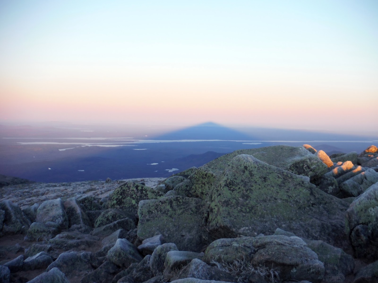
Now for the most exciting part for me.  I turned around to see the mountain shadow cast into the air opposite the sun.  I just learned how mountain shadows like these actually work.  I had seen pictures of them from Mt. Fuji or other large mountains, but what I didn't realize is that they are triangular not because of the mountain shape, but because the sun is a disk of light rather than a point source.  This causes the mountain shadow to taper off after a few hundred miles.  So this dark triangular shadow is actually a 3-dimensional tunnel-shaped void of unlit atmosphere.  The shape of the mountain would be cast at the end of the tunnel, but it is so small by then that it's rarely distinguishable.
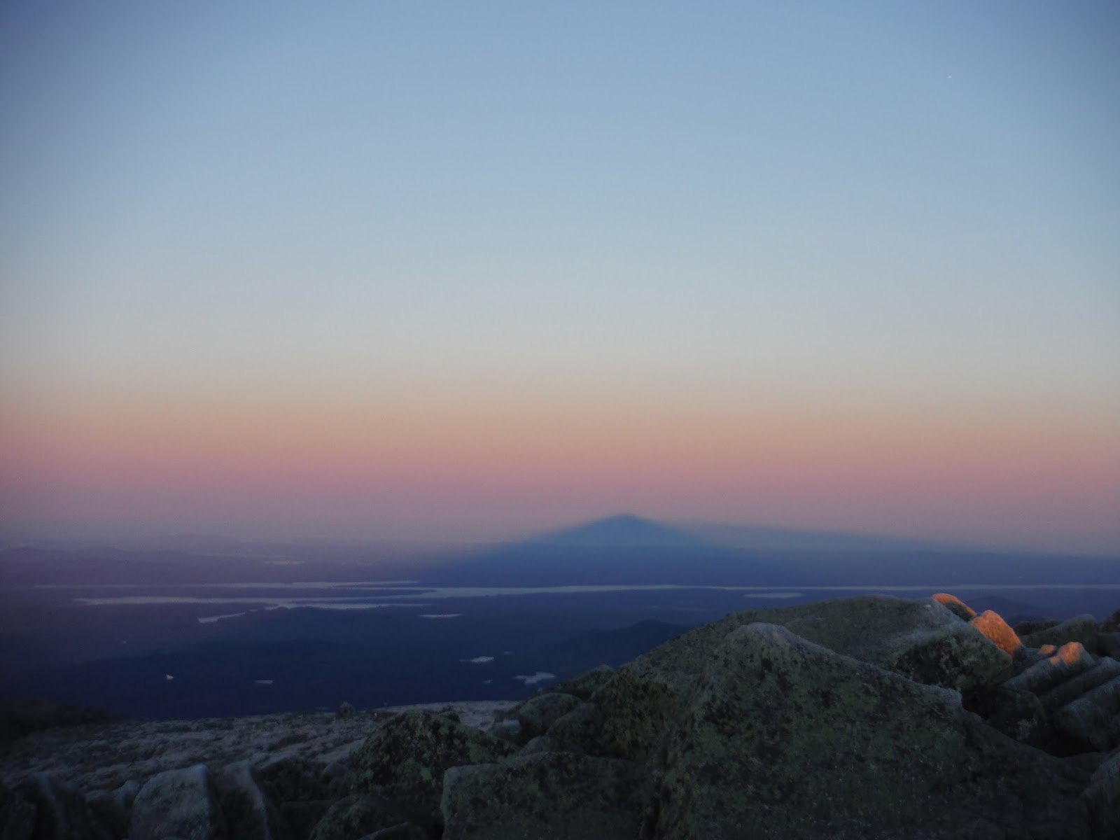
Mountain shadow
Below is the mountain shadow from further back.


Fire and ice.

Mountain shadow sinking onto the Earth's surface
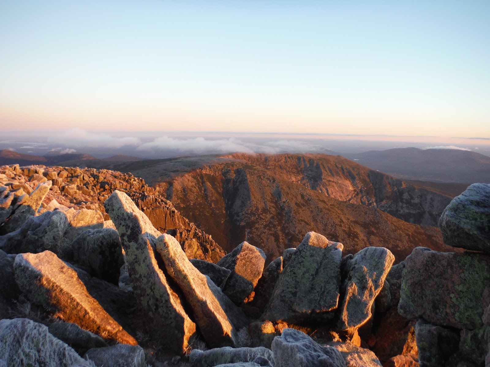
Morning light cast into the North and South Basins
After snacking on some food as fast as possible due to cold and wind, I decided to get one last look at the sun before heading down along the tablelands.  I was scheduled to meet my mom and her sister Becky at Daicey Pond for breakfast,  They had come up the day before and had spent the night in a cabin, and I  came in to join them for a day of hiking around the park.


Tablelands, laced with rime ice and sunlight.
It looks calm and peaceful.  No.  It was fierce winds that had me wrapped up in every layer I had with me: three fleeces, long underwear, wind shell jacket and pants, a hat, hood, and a balaclava.  I'm sure I looked quite silly, but that's okay since I was the only one up there. :)

Heading down to Thoreau Spring, I was able to photograph the ice that took my by surprise on the way up.  (Luckily no falls!)


At the edge of the tablelands, the Hunt trail descends sharply into the valley along the spine.


After descending the spine, this is the view back up.  It is stunning from every angle if you ask me.


The hike down was a breeze (no pun intended, despite the strong winds still beating at my hood and flapping about).  It was well below tree line when the layer came off again.  I saw over 20 people on their way up, and I hope for their sake that it warmed up a bit with the sun up on the top.

One mile from the trailhead, I stopped to visit Katahdin Stream Falls for a minute.  The roar of the crystal clear water was soothing.

Katahdin Stream Falls

Hike Data
Miles hiked: 10.6
Time elapsed: 5.7 hours
Total ascent: 4200'


Sentinel Hike

I joined my mom and my aunt Becky for breakfast at their cabin over at Daciey Pond.  (You may be shocked to realize that this was my first ever visit to Daicey Pond, even having worked in the park for 3 months.)  I had surprised them with the news that I had done a sunrise hike of K. But sometimes things are best done without prior knowledge (at least for some people).

We took a short drive over to Kidney Pond, where the Sentinel Mountain trail takes off.


This was a trail I had worked on for two weeks during my time on trail crew.  Below, I was showing my mom some of the steps we built.  The one she's standing on was a massive 400+ pounder that took four of us to move up the trail into place.  I have such an appreciation for rock steps on trails after having built some.


Heading up the steep section at the end, I ran ahead to take the picture. Inadvertently, it looks like my mom is picking up a huge yellow leaf.  (It's actually a normal yellow leaf, if you would believe it.)


From the scattered bald patches on top, we had a fantastic view of the mountains around, from Doubletop (seen below), and across the Nesowadnehunk Stream to OJI, Coe, Barren Mountain, and finally Katahdin to the far right.

Doubletop Mountain.  One of my favorite viewpoints in the park.
(I can't say the same about the trail itself though.)
Gazing out over the valley
Posing with the beloved K in the background
From Jackson's Landing along Kidney Pond, this was a familiar shot of K.  Every day was a little bit different, either with the fall colors changing or with the weather and the clouds doing their own thing every day.


Back at Daicey, the view from the cabins is much better than those at Kidney.  As the sun set behind Sentinel, we saw some alpenglow on K (which I was very much hoping to see and point out to my mom and Becky).  Alpenglow is just the pinkish or purple color that mountains will take on given certain conditions at sunset.  Very pretty phenomenon.  I have seen it a few time on K before, and once out in Moab, UT whilst tripping around with my pal Noah (Count Noah I should say).

Alpenglow
Hike Data
Miles Hiked: 6.0
Time elapsed: 5 hours
Total ascent: 760'

In closing, I have very happy that my aunt Becky got to spend such a nice time for her first visit to Baxter.  I am happy that I got to visit the park at the same time as my family, since that has never happened before.  My parents went up long before I was born, but never with me. It is a special place to me, since I worked hard for 3 months to keep the trail system alive and maintained.  I will forever respect it for its grandeur, beauty, and wildness.  "Forever wild." as Gov. Baxter would have said.

Friday, July 31, 2015

Katahdin Sunrise Hike!

One of my bucket list items: a sunrise from Katahdin.  Well this was my chance.  Without getting too much into the details, let's just say I have some privileges as ex-staff at Baxter State Park, and was able to acquire access to the park at the time of night needed to start for a sunrise hike.

I brought Eliot along for his first visit to the park, which both of us were very excited about.  I love to bring new people to Baxter, where I spent three months of my life in 2014 as part of the trail crew.  During that time, I grew to love the park very deeply.  It was a home for me, and there is a magical essence that I feel every time I come back.  Long story short, I try and show to new visitors why it is such a special place. Hopefully the following pictures can help that message come across.

We began our hike from Roaring Brook campground at around 1am, with a nearly clear sky to ourselves.  A rainstorm had recently passed through, compromising our confidence in a good-weather hike, but as the moon shone through the trees, hope was restored.

The trailhead, with Helon Taylor waiting for us.
The next few hours passed by pretty smoothly, and I didn't take pictures because there was a whole lot of nothing to see in the darkness.  The Helon Taylor trail goes up steadily and slowly, at least compared to some of the other trails.  There were some patches where we were able to see just enough to hike without headlamps for a little while.  The moon was to the left of Pamola Peak, which we could see looming ahead with clouds whipping by at immense speed.  As soon as we began to hit the bald ridge that Helon climbs toward the end, we got to experience the aforementioned wind first-hand.  It was incredibly windy, and the issue was not staying up, but instead adjusting to varying gusts of wind.  We would adjust to a strong gust, then it would go away, causing us to nearly fall over.

Here are several things I very much enjoyed about hiking on a night like this.

  • We had the place to ourselves.
  • The moon and sky are beautiful at night.
  • It's cooler at night, and you don't overheat.

Upon reaching the final section of the Helon Taylor trail, the sky began to brighten with hints of sunlight.  At Pamola Peak, a red-orange glow was visible, and was perhaps one of the more beautiful skies I've seen.

Pre-dawn glow from Pamola Peak
We took some time to munch a bit, and as the sky got brighter, unfortunately the clouds began to roll in.


The opposite view was dark and stormy, looking across Knife Edge.  We chose to continue along it since it was getting cloudy anyway, and it looked like we may miss the sunrise itself.


The Chimney is one of my favorite parts of the Knife Edge.

Eliot scaling down into the Chimney
Katahdin Lake behind Knife Edge
We had to be extremely careful due to slippery lichen on the rocks due to the dense fogginess.  Aside from clouds condensing on our hair and eyebrows, all was well.

Eliot killin' it
Looking back to where we'd come, a gap in the clouds provided a bit longer of a view.


Slowly crawling up and across South Peak, we made it to Baxter Peak, where a large pile of rocks stands tall for all hikers.

Great view right?
I convinced Eliot that we should hang around at the top because I knew for some reason it would clear up.  From past hikes, I knew the view was absolutely stunning, and to hike on and miss that would be a shame. After some more munching, the sun did make an appearance!  Six hours into the journey, and we got to see the sunlight.

Baxter Peak at 7am
Looking north across the Tablelands, the summit sign sits on the throne that we call Katahdin, or Ktaadn, as it was once spelled.  It was fulfilling to see this summit for the third time.  It never gets old - it's just too special of a place to become boring.


Looking behind us, the Knife Edge became visible, showing just how gnarly a piece of rock it is.


The rocks are very square up here - perfect for lying down
We then headed down the Saddle Trail, with the intention of either going down the saddle or up to Hamlin Peak depending on how we felt.  It was around here that we saw our first person of the day.  He was hiking up the Saddle Trail, likely from Chimney Pond CG, after having looked at everyone's start times in the register at Roaring Brook afterward.

The Chimney in the background
Index Rock and the Chimney
We did end up going to Hamlin Peak, however we were blessed with more clouds, and walking through a patch of krumholtz soaked our pants.  At the summit, we saw another hiker who had come up the Hunt Trail.  Together, we groused about the cloudiness.  I would like to return in fair weather to see the view from that summit, since it looked neat from Baxter Peak.

Eliot was very happy on our descent along the Hamlin Ridge Trail.  The sun had returned.


This was a new trail for both of us, and I admit the view from this ridge is quite amazing.  You can look right into the South Basin across to Knife Edge, or to the left into the North Basin, where Blueberry Pond lives.

South Basin and Knife Edge

After entering the tree line, we found a small unnamed pond with crystal clear water.  The northern ridge of the Katahdin massif is in the background.


We rejoined with the Chimney Pond trail, and stopped by Basin Pond to get a view of the South Basin once again before leaving.


One week during my time as BSP Trail Crew, we worked on a waterbar reconstruction on the Chimney Pond Trail, and I was pleased to see it held up so well over the winter.


After twelve hours on the mountain, we returned to the parking lot and ate many cookies!  I offered to drive Eliot to the other side of the park, up to Kidney Pond, where I lived last fall for the Trail Crew operation.  I saw Dean, the ranger at the campground, and he let us take out a canoe to see the surrounding mountains.  From left to right: Moose Mountain, Doubletop (pointy), West Peak, OJI, Barren Mountain, and Katahdin.


Here is proof that we at least sat in a canoe.


All in all, it was another beautiful day in BSP.  We left the park very tired, and ended up taking a nap at the Trading Post by Ambejejus Lake. Three hours later and fueled with caffeine, I was ready to make the trek back to Monroe.

Here is the Google Earth track and elevation profile for the hike.  (We went clockwise.)  Distance was 11.5 miles according to the map, though know knows....