Showing posts with label new york. Show all posts

Saturday, April 18, 2015

2015 Road Trip: Part 3 (NY-OH)

New York to Ohio
Day 5
4.18.15


I got up early on Saturday to prepare for a long day of driving.  My goal was to drive all the way from Union College to Oberlin, OH to meet with Josie and Colin.  And I got nothing worse than another clear day for the drive.  I consider myself quite lucky so far to get all this beautiful weather for traveling.  It was funny being up so early on a Saturday at a college, because typically everyone (or most people at least) are sleeping through their hangovers from partying on Friday.  Because of this, all was quiet as I loaded Wombat with all my gear for the drive.

Terrace Lane at Union College 
The reason I chose to take the southern route through New York is primarily to avoid the absurd number of toll charges that I-90 rips from you.  I was more than happy to take a slightly bumpier and longer route through the rolling hills and farmland of southern New York instead. Good morning I-88.  I found myself halfway up the hillsides, looking down into valleys, winding up and down with the landscape.

I-88 westbound
I did encounter some patches of heavy fog that made it slightly ominous driving at highway speeds.  As the sun rose higher, the fog burned off and I was left with blue sky overhead.  One thing I noticed while driving through this area is that there are a peculiar number of towns and cities that begin with vowels.  Oneonta, Endicott, Owego, Elmira.  In Maine, we have solid sounding names like Jefferson, or Portland, or Monroe.  In New York, I felt like I had a bunch of gummy bears in my mouth trying to pronounce these towns.

In preparation for this long drive, I found a fire tower that was still standing (apparently many aren't) to visit for my lunch stop.  Because no one wants to drive over 500 miles without stopping.  This added "POI", in GPS terms took me off the highway and into the Finger Lakes Region. I remember a lot of this landscape from my visit to Ithaca College a few years ago.  Everyone had silos, lots of farmland, and most shockingly, everything was GREEN!  I left my house with snow half covering the field.  Here it looks like summer.  I feel like I am on an expedited tour of the seasons.

Evidence of greenery.  And look at dat swing.  Mmmm.
This fire tower is located in Sugar Hill Recreation Area, just southwest of Seneca Lake.  I had the place to myself.  Very serene.  I packed lunch ingredients into the lunchbag, and headed up the short road to the tower.  Must climb tower - maybe lunch on the tower.

Sugar Hill Fire Tower

A building.  Not entirely sure its purpose.
Well, having climbed to the top, I discovered the cabin to be locked. There is a trend with locked cabins.  I should stop counting on being able to get inside them.  However, I maintained optimism, and created some lunch.  (It was double PBJs and a banana if you were wondering.) Obligatory tower selfie:


I had a goal of reaching Oberlin by 4:30 for a game of ultimate frisbee.  I became aware around this time that I had a very small chance of getting there unless I attached some jet thrusters to the car.  Despite this problem, I saw some exciting things following the not-so-great roads from the tower back to the highway.  I encountered a farm with a turkey and a goat sitting in a pen together.  Promptly after this, a beaver crossed the road.  Here is said beaver:


After finding the highway, the last (and endless) part of New York passed without too much drama, though I got very tired of the badly constructed concrete road sections.  I was blessed with a totally redone section to guide me into the great state of Pennsylvania.  As you can see on the left of the picture below, my windshield became an overpopulated graveyard for bugs.  SO MANY BUGS.  And they don't scrub off easily.  They persist even when dead.

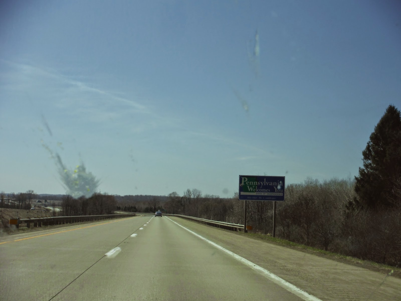
Welcome to PA.  And a bug.  Or what used to be a bug.

I like to try doing something outside in each state I visit, but I was only in PA for 50 miles, so I didn't do much aside from opening the window.  My GPS told me there was a chance I might make it for 5pm, and I could hope that the game would still be in progress.  I'll tell you most of the rest of the day looked an awful lot like the above picture, but imagine about 50 more cars per lane in front of me once I hit Cleveland.

I arrived in Oberlin, very excited to stand up after 560 miles sitting, albeit in various positions.  Below is the map of my progress for this leg of the journey.  Total miles covered is now up to 1062!


Ultimate was so fun I didn't even get any pictures.  Then again, who wants to see a picture of a bunch of sweaty college students?

The day came to a close with a wonderful dinner cooked by Josie.  We had authentic chicken parmesan with alternative pasta and broccoli. There's nothing like having a home cooked meal after a long day.  I was taught to play a ridiculously stressful card game called Golf that evening. Like the real game of golf, you are aiming to end up with the fewest points, yet actually knowing which cards you have is controlled by very strict rules.  As usual, Colin won.

This post was on the longer side, so I will save my outings whilst in Ohio for Part IV of the trip.  Enjoy!

Thursday, April 16, 2015

2015 Road Trip: Part 2 (VT-NY)

Vermont to New York
Day 3
4.16.15 - 4.17.15

Thursday began with yet another beautiful day with warming temperatures and a clear sky.  Today my goal was to drive in some convoluted fashion to Schenectady, NY to see some friends from Union College.  As per my usual incessant planning, I checked google maps again to see how long it would take, and the result was around 3.5 hours.  But that was the fastest route, and I could have used a feature for "most beautiful route".  The route I ended up taking certainly took much longer than 3.5 hours, but completely worth it, as the Vermontian countryside is one of the better things in the world.

I took a leisurely start to the day, and pulled out the paper maps to figure out what roads might be fun to check out.  This is the joy of being on a solo road trip.  You can open up a map, say "I want to go here," and just do it without any worry that you won't get back in time, or that it's in the wrong direction.  I admit, a GPS is great for getting to a destination, but when you want to experience a journey, paper maps is where it's at!

With my start point of Waterbury, VT nestled up in the northern Green Mountains, I was interested in following the whole range south and then crossing over into New York later rather than sooner.  I have no regrets. I chose Rt. 100 to start with, and let me tell you, there's nothing quite like driving alongside the bumpy Green Mountains for miles and miles, where every bend in the road gives you a new mountain to look at.

Rt. 100 was going great and all, but then spontaneity got the best of me, and I went westward to cross over the mountains via Rt. 17.  I passed by a ski area, started racking up the hairpin turns as I gained elevation to Appalachian Gap at 2375'.

Appalachian Gap, Rt. 17
The descent was just as beautiful, just seeing the mountains pass by you as you carve the corners into the valley.  It's always handy to have effective brakes in the situation.  Having crossed the mountains, I was now on the western side, I suppose in the Lake Champlain valley...I'm not sure if that's official or not.  I passed by lots of farmland and some little towns as I made my way south.  A pleasant place to drive through.

Rt. 116
Eventually temptation took over once again, and I saw a sign for Rt. 125, Scenic Byway, which - you guessed it - crosses to the other side of the Green Mountains.  This road, however, followed a stream of sorts instead of gaining lots of elevation, but that was equally enjoyable.  It seemed like a road you'd see in a national park (this is probably because it's in a national forest).  Your feet get a good workout along this route with all the curves and hills.

Rt. 125, Scenic Byway
Because of my late start, I was beginning to crave some lunch.  So here began the search for a picnic area.  I had rejoined with Rt. 100 again now that I was back on the east side of the mountains.  I spotted a small picnic area by a stream to have some lunch.  It was beautifully located by a hayfield that hugged the hills, and a farmhouse on the opposite side of the water.  I had the place to myself, made some lunch, and walked along a small trail that followed the stream to a rocky beach a ways down.  This was my opportunity to stretch the legs, since there isn't much variation in driving positions.  The legs were happy.

The field by my picnic spot!
The White River

After lunch, I continued along Rt. 100 southbound, which does eventually go the length of the state.  There was not a shortage of mountains along the route, nor ski areas.  I passed Killington, and quite a few others whose names I didn't pay much attention to.  At some point I saw this cool bridge and had to take a picture of it:


My journey along Rt. 100 finally ended in Wilmington, where I began to cross the mountains for a third time along Rt. 9.  I have been on this road a few times commuting to and from Union College, when I thought the standard highway route was too boring.  I have to say that by this point, even I was a bit sick of driving, and I tend to enjoy it.  I think I was about 5 hours in, and when it's all state roads, I just wanted to sit back and set the cruise control.  That doesn't work well on state roads.

After crossing into New York, my fourth state on the trip, I discovered I had timed my arrival into the Capital District (Albany/Schenectady) perfectly for rush hour.  Apparently I don't drive aggressively enough for New York, based on some of the stuff I observed in my rear view mirror. However, I did make a successful arrival into Union College, after 10 months of absence.  I know there were things about college there that I didn't like so much, but getting to see the people I met at college was refreshing.  Kicked back, did a bit of gaming, and got my signature chicken parmesan sandwich from the dining hall, and then nostalgia arrived at the party.

Here is the map of my progress along the trip.  I completed 237 miles, bringing my total to just under 500 miles.


Normally I have a heading for each day, but Day 4 was pretty low key, and I spent it doing some route planning for the next few days, and trying to get all the old roommates together for dinner.  Over the course of lunch and dinner, I was able to see everyone at least once, which was great.  The great part about doing this trip, is that whenever I go to visit someone, I get to share my story of the trip so far, and it only gets more interesting as the trip gets longer.  I also determined from seeing glimpses of some engineering textbooks from my sophomore roommate, Benny, that I am extremely glad to have made an alternative plan for this year.  I'd much rather be seeing the world go by me right now, hence the trip.  Cheers!