Showing posts with label arizona. Show all posts

Wednesday, May 20, 2015

2015 Road Trip: Part 22 (AZ-NV)

Arizona to Nevada
Hoover Dam
Day 37
5.20.15

It was with regret that I left Arizona to begin another phase of my road trip.  I had a wonderful time with exploring bits of the Colorado Plateau with Noah.  Those three weeks were dense with adventure, which is the way it is best.  This new phase began with a drive west toward Hoover Dam, to meet up with Eliot on his way from California to Salt Lake City.

US-93 north in AZ
As I drove west, the desert got even more deserted, and trees were a mere concept, and I was left with valleys and barren mountains along the edges.  I drove up US-93 on the east side of the Colorado River, and Eliot was driving up US-95 on the west side.

In the style of Top Gear, "I was the first to arrive."  I first went to the Lake Overlook, since I figured that would provide a better view than the dam, otherwise the dam would have been called Lake Overlook.  Here is Lake Mead, the largest manmade lake by volume in the US, capable of holding two years worth of Colorado River water.

You can see how low the water level is compared to what it used to be. The light rock was all underwater, and now it's exposed, and my estimate is that it is somewhere around 100-200 feet difference.


After driving across the dam, I drove up the opposite side a bit to find parking, and got a better view of how low the water really is.  The water used to cover most of the four intake towers.


Soon, Eliot arrived, and we headed down to the main hub of things, looking to take a turbine tour inside the dam.  This is one of the spillways used to divert water in the event that it rises higher than the top of the dam.  I believe these have only been used twice in the history of the dam.


They take you down to nearly the base of the 700' dam, into one of the diversion tunnels used initially to change the course of the river for construction.  From there, it was a short walk into one of the turbine rooms.  There are 17 turbines, 8 on one side and 9 on the other.  They are spun by the water forced into it, and this causes it to spin.  They produce electricity via electromagnets on the turbines and also stationary (called the stator coils) in a ring around each turbine.


We sat in for an audio recording that explained the usage of the Colorado River and the 15 dams along it.  It was enhanced by a cool light-up model of the area showing terrain and all the main dams.  The perspective of the model was very confusing for anyone who has read a map before.  South was basically in any direction on the edge of the model, and north was divergent along the horizon.  But there didn't seem to be any cohesion of longitude lines on the map.

We walked back along the dam and got to look down it.  It's pretty damn huge.  Sorry, I had to.  It's one of those things you want to roll a penny down and see how long it takes.  They tell you not to because there are poor workers down there, and they might not be wearing safety helmets. Which would be a violation of OSHA, but that's okay.  I wouldn't say anything.


The bridge that I crossed over to get to the dam is way more impressive from below.  I'm almost glad I didn't see how spindly it was while I was on it.


From there, Eliot and I parted ways.  He went into town to spend the night, and I muddled around in the back streets of Boulder City, NV to find a grocery store and some internet.  Eventually, I was successful, and I had found a campsite north of Las Vegas by about 40 miles.  It was near the Valley of Fire State Park.

I had an initial opinion of Las Vegas, and it was "ew".  However, everything was different when I was coming from a desert with nothing living in it.  With nearly clear skies, the glow of the sunset and the city was all very inviting as I neared the hubbub.  I basically stayed on the highway for the whole time, but it was still very exciting to pass through a place so energized and filled with flashing lights and fast cars and places telling you why you should gamble here instead of there.  In summary, I had a blast.


I arrived at my campsite along a dirt road (as usual) late at night.  It really wasn't much, but I can't expect much for free.  There were a few fire rings, and room to set up a tent.  What was cool was the view of the Las Vegas glow.  No lights directly, though I got those in my rear view mirror heading up I-15.  That was pretty rad.

The worst part about this site was the amount of bugs that were really excited about my headlamp while trying to cook and eat dinner.  They were some cross of an ant and a wasp in looks, and worse than blackflies in attitude.  I resorted to eating by red light on my headlamp. With partly clear skies and no rain in the forecast, I left the fly off the tent for maximum stargazing ability.  That was unsuccessful since I typically sleep with my eyes closed.  Yahoo for a night without any snow though!

The Route Maps begin again, now that I am making some noticeable progress around the country.  To date, the total is 6352 miles.  Many more to come.

Day 37: 327 miles.

EDIT: I have received photos from Eliot, proof that I did indeed see him.  Here's a picture of us during the turbine tour.


Sunday, May 17, 2015

2015 Road Trip: Part 21 (Humphrey's Revamped)

Humphrey's Peak Again!
Day 34
5.17.15

Noah and I were taking a few days off after our fun jaunt in the southern half of Utah, and what turns up on the Flagstaff hiking club meetup online?  Hike up Humphrey's Peak on Sunday.  You know I can't say no to that.  It was my new favorite mountain!  I'm not sure who talked who into it, since Noah asked me about it, but I agreed and told him we should do it.  So it just was us and a guy from the hiking club going up. However, the last few days had resulted in about another foot of snow on the peak, which did end up making things interesting.

The view of the San Francisco Peaks from town.
We began a bit late, but that's how it goes - Dan from the hiking club wanted to meet at Walmart at 9am, and so it was.  He did not have snowshoes with him, and when he saw us with ours, he was worried about not having any, so we stopped by one of the many outfitters in town, and the lucky duck got a pair for the off-season price of $60. Clearly May is the time to buy winter gear if you can find it.


We arrived at the trailhead at the AZ Snow Bowl once again, though this time the field was snow covered.  In only 11 days, the conditions had changed immensely.

Noah licked a sign this time.  Not me...I wouldn't do such a thing.
We began up the trail, which was all covered in snow, and the trail was broken, which surprised me.  I was thinking that after all the snow, we might be the first people out, but I was wrong.  Also, with our late start, others had been up before us, as the register confirmed.  (The register is over a mile in along the trail, which seems like a horrible idea if you ask me.  I doubt anyone checks it.)

I had a horribly devious plan in my mind the whole day, which was that I wanted to ascend along the ravine again, even though we now knew where the trail went.  I didn't say anything for awhile, but eventually, when we stopped for a food break, I broke my idea to everyone.  We decided that I would go that way, and since I knew the way, the chance of me getting lost was low.  Whoever made it to the peak first would wait for the other, and I was pretty set on now going down the ravine glissading like before due to the snow conditions.  It was too deep and too sticky to get any kind of slide going.

Shortly after I departed from the trail-goers, I started ascending the scree field (#1, since there are two, the second one being the major ravine).  I was instantly gifted with no trail broken, or even footsteps to follow.  But I did see a man in orange who I thought was going to follow me.  He sadly didn't come up behind me, however he is visible in the distance of this image:


The "trail" from here veers to the left, and following some occasional pink flagging tape that I remember seeing before, I was able to make my way in the right general direction.

My view ahead for most of this segment of the journey.
Soon, the trees opened up, and I was presented with the view that made me want to go this way in the first place.  I think this is one of the most gorgeous views I've seen when hiking.  It's better than a summit in my mind, because you can get the view looking up, as well as looking down over the valley if you turn around.


A bit closer...

I arrived in the ravine, this time already in the snowshoes, since I couldn't have made it up this far without them.  Deep sticky snow...  I reapplied sunscreen, and since both Noah and I neglected to do so last time, we wanted to be sure not to get burnt this time.


You can see the trails of little snow bits that fell down the hill.  I thought this was cool, but I was a bit too preoccupied with breaking trail up this steep slope, and I now have full respect for the exhaustion that Noah experienced on the last hike up here.  With the added effort of breaking trail, I think I was taking breaks much more frequently.  I just remember wanting to take a nap after every step.


The signature view along the ravine.  I was looking over at that rainstorm in the distance periodically for an hour, happy that it wasn't on me. Schadenfreude I believe this is called.


I took a chocolate eating break at nearly the same spot as before.  I wanted to eat earlier, but getting to that spot was my only motivation at that point.  I allowed myself to sit down in the snow, but only after every 5 steps.  Otherwise, I figured no progress would be made.  At one point, I saw a few people hiking down along the ridge, and I could almost hear exactly what they were saying, despite I could hardly see them.  Sound carries far in the mountains - if the wind is on your side, that is.

After what seemed like an eternity, I reached the ridge.  It lost a portion of its magic since last time, since I'd seen it before, but it was still beautiful as ever, and much clearer skies this time.


I left my snowshoes and poles behind here, since I didn't need them for the final summit push.  Also, weight savings, so why carry them?  In the photo below, you can just see two guys heading up - they were from a fire crew, I learned later from Noah.


I arrived at the top and just sat, because that's all I wanted to do.  I also shouted for joy, but that took some breathing preparation at 12k.  Soon the fire crew people arrived, and kindly took my picture in front of the sign.  They offered me some BBQ kettle chips, which made my day. They are now one of my favorite hiking snacks.  What I like about them is that I forget quite what they taste like every time I stop eating them, so every new chip-eating session is like the first time all over again.  Try them if you haven't - but also make sure you have funds to continue buying them forever, because you'll need to.


After hardly 30 minutes at the top, Sir Noah arrived, though he was solo, and I was confused by this.  He made it to the top, and we enjoyed our hot beverages in thermoses.  He brought coffee, and I brought hot chocolate, though mine was oddly cold at this point, and that made it not so great, considering I had melted butter it in, which was now congealed. Somewhere before the steep part on the trail, Dan from the hiking club decided that he was probably not going to make the summit any time soon, due to breaking so often.  It was then that Noah shared some of his food with him and said to either wait there or head back down the the car.  His wife would be able to pick him up if he returned to the trailhead before us.  We agreed to go down the trail to make sure he wasn't still waiting along it somewhere.

It had taken me 6 hours to make the summit, even with 1.2 fewer miles to hike.  This proves once again that straight up is not necessarily the fastest route up, at least not by much.  Because of our late start, the sun was lower by this time, and we could better see the shadows hitting the far wall of the Grand Canyon, making it stand out.  Also, along the cornice of the ridge, the late sun shadows were filling up the valley of the San Francisco peaks.

Staying back from the edge a bit for safety.
Noah seizing the mountain air
Noah led the way down, since we chose to take the trail back.  I learned that he had actually taken a slightly longer route up than expected, since the end of the trail before the ridge consisted of many failed attempts, so all that was there was people giving up and hiking directly up the slope. This brought him up further toward Agassiz Peak, to the south, making him hike along the rim for a bit longer.  On our way down, we found to correct way down, which was at the saddle (or col).  Getting there was challenging with the length of my snowshoes, since we had to maneuver around pointy rocks.  I got frustrated with my poles and threw them down so I could use my hands.

Once down the steep part, the benches of trail proved to be a much easier way down, and with the sun setting, the slush that made everything soaking wet in the morning had hardened up into a crust that was easier to snowshoe on.

We once again met up with my departure point, scree field number one, and I had to go out and look at the sun and the evening sky.


Soon after, the sun was just going below the horizon, and created an awesome gradient along the clear sky.

Sunset on Humphrey's
The clouds in the distance glowed bright with the sunlight even after the sun had set.


We had to bring out the headlamps for the last few miles, but it was completely worth seeing the sunset from this vantage point.  There were a few campers toward the base of the trail, who managed to be having a small campfire even in wet, snowy ground with wet, snowy wood that was around.  Wizards, they must have been.

Ten hours after T-0, we arrived at the good old Blue Burro, very ready to come back to a house.  (Blue Burro is Noah's van for those not in the know.)

What I am most impressed with is that one two hikes up the same mountain within two weeks, the experience was completely different. I've very glad to have done it twice during my time in the Flagstaff area. These experiences will never die; they will be remembered, at least in their insanity.

Wednesday, May 13, 2015

2015 Road Trip: Part 20 (Confluence)

Trans-Utah Loop: Canyonlands NP
Confluence Trail
Day 30
5.13.15

We had gone into Moab again after our hike yesterday to find a place to stay that would be near our second hike in the Canyonlands, this time in the Needles District.  However, after 20 miles of hiking, we were both tired and hungry, so we decided to head back to Horsethief CG again, where we had stayed the night before.  Not exactly close to the next day's trailhead, but we knew it was there.  On the way however, we saw a sign for Lone Mesa CG, which appeared to be free, which was better than the not-free Horsethief.  After bushwhacking through a maze of RVs, we eventually found a place where we could set up.  No picnic table, but a beautiful view.  Here's our site the next morning.


I've been having a great time bopping around Utah, but there is one thing I truly despise, and that is the amount of fine sand and dust that gets on everything after awhile.  It had been windy the night before, so cooking was moved to the back of the car with the hatch open, but even with that, sand got on every piece of cooking equipment we had with us. Anything that moved now had a nice gritty-scratchy sound to it.

All of that was forgotten by morning when the wind had died down, the sun rose once again, and shed light over the area, and presumably Lose Mesa, which it what I think is in the photo below.


We began our journey out of Island in the Sky, and down toward Needles, which was a surprising distance.  It was a lengthy 100 miles just to get to the trailhead for the Confluence Trail.  The confluence in question is of course the Colorado and Green Rivers.

Rt. 211 is the way into Needles District, and it is quite the drive.  Many buttes and mesas along the way to keep you entertained.  Not to mention petroglyphs as well.

Rt. 211 into Needles District.
We stopped by Newspaper Rock, known for a giant wall of petroglyphs. It's strange how abstract many of them are, for example humans with antlers and the silhouette of a flying squirrel, or a 7-toed foot.


Finally, we made it to the end of the road.  Literally the end.  It just goes in a loop.  The way onward is by foot.  So that's what we did.  The mileage of the trail ahead of us remained more or less a mystery due to more conflicting information.  I tried my best to ignore this fact and just enjoy the trail.  It was challenging.  Noah can confirm that I was frequently out squinting at the map, trying to figure out how 1.1 miles was equal to 0.7 miles.

In no fewer than three minutes after departure, we had lost the trail.  We were faced with a gorge that was supposed to have some switchbacks (maybe?).  Using the high calculating powers of our brains, we once again found the trail, marked with microscopic cairns that would make ants frustrated at best.  Once past the initial gorge, there is this funny part in the trail where you duck below these rocky outcroppings.

Duck duck goose.
From all we learned working in Baxter State Park, we knew that trail preservation was of utmost concern, especially in high traffic areas such as national parks.  Noah did his best to keep the boulders in place.

Trail work in progress 
Crossing meadows of grass and lots of globe mallow, we found yet another view of the La Sal Mountains.

La Sal Mountains
Using simple geometry, we concluded that using the hypotenuse of the camera's dimensions was the most effective way to get the most horizon per megapixel.


Though nothing beats the power of the panorama.  Have a look for yourself.  La Sal Mtns. to the left, Needles to the right.


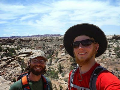
Proof that it was really us doing this hike.  I look like I was in a pin-fight because I lost a battle with the Sun on our Humphrey's Peak hike.  It's fun regrowing your face every once in awhile right?


Windswept sandstone lined parts of the trail.
The trail joined up with a 4x4 road for a mile or so, then it continued as a hiking path for the last half mile, and it doesn't get much better than this at the end.

Colorado River!  (Green River going behind the canyon to the back left)
The Colorado River is muddier than the Green River.  However if you remember from the Grand Canyon pictures, the Colorado is emerald green.  This is because of a dam that created Lake Powell in southern Utah.  This slows the water down enough for the sediment to sink to the bottom, allowing for the clean water to pass through.


The ultimate Colorado River fan!
We spent a leisurely hour at the confluence, eating melted sandwiches, the final scraps of out banana bread batch, and a delicious bag of Barbecue kettle chips.  These have become a staple of our lives now, hiking or otherwise.  I nearly fell asleep on a rock, which would have been fatal due to over-exposure to sunlight.  Aside from this potentially bad situation, it was grand lying on a rock and being warmed by the sun.

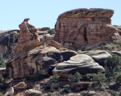
We worked up the motivation to hike back out, mostly because we wanted to make it back into Flagstaff that evening, and that was over 300 miles away.  My strange eye for seeing shapes in rocks engaged once again, and we spotted this eagle looking over its shoulder.


We passed several people on our way back to the car, and one group commented that we were going quickly.  Noah countered them exquisitely by saying that we were only trying to stay ahead of the bear chasing us.  (Something tells me they didn't buy it...)


As we neared the end of the trail we saw what we had missed on the way out.  Five pillars of rock lined the horizon.  Rocks be funny hereabouts, eh.

If you take a rough average of the different trail lengths that were provided to us, you get something around 10 miles roundtrip.  It was a memorable way to end our trip, by visiting the point where two great rivers that carved out this park and many more miles in each direction meet.

We celebrated with hot beverages - just the thing you want on a hot day in the desert.  Noah brewed himself some coffee with his new space-age device, and I had some uncomfortably sun-baed root beer.  When you forget to put it in the cooler, the sun does tend to make liquids hot.  I think it was probably the worst root beer I've ever had, but that didn't stop me.

We began the trek southward to Arizona!  330 miles remaining.  We got to see the La Sal Mountains fade away, but in their place appeared more mountains.  Also, bright green fields, which I was shocked to see in such a dry place.  You'd think the cows would be all over it.  Zero cows.  In fact, I think what they raise out here in the west are highly evolved camels with short necks, not cows.  Because the cows I know about need water and grass to grow.

We rolled through miles and miles of desert road, with buttes and mesas in every direction.  Soon the sky became darker, but it was so expansive that it took awhile for true darkness to set in.  What came first though, was an inability to see through the thick coating of bugs that had decorated my windshield.  An emergency glass-cleaning stop was made.

Around 9:30, AZ time, which would be 10:30 UT time since Arizona doesn't observe DST, we happily rolled into Flagstaff.  Six days in the backcountry, exploring what Utah has to offer.  Fifty miles hiking, 1500 miles driven, and many delicious meals prepared from the mere back of a wagon.  It doesn't get much better than that.

To conclude the Trans-Utah Loop posts, I present the complete map of the 6 days we spent traveling.

Trans-Utah Loop
PS: Wombat crossed over 170000 miles near Bluff, UT.  Congrats for making it 6025 miles along the trip so far!  We've got a lot left to make it back to Maine, but great it shall be.

Friday, May 8, 2015

2015 Road Trip: Part 14 (Zion)

Trans-Utah Loop: Zion NP
Day 25
5.8.15

Here begins the second phase of my road trip!  A Trans-Utah Loop to explore National Parks, and see what southern Utah has to offer.  This trip required some shifting around of things in Wombat, since Noah and I both wanted to go on this trip.  With our things eventually packed in some way into the back of the car, and me getting a horrible night's sleep, we filled with petrol in Flagstaff, and began our way north along US-89.  This would take us to the Vermillion Cliffs area, near Page, AZ.

Trans-Utah Loop, Day 1: 353 miles
A side note - the reason for my not so great sleep may have had something do to with being distracted with some GTAV, which then pushed the banana bread baking process several hours later than it ought to have been completed.  When baking banana bread in larger pans, the baking time increases from 45 minutes to several centuries. Not sure if altitude has anything to do with this, but it took its time.  And then there is the cooling period.  During this time, I watched a mountaineering documentary to keep myself entertained.  It was about the first ascent of the west face of Siula Grande in the Peruvian Andes in 1985.  All of this for the banana bread, which as you may have noticed, is TOP priority when hiking in the desert of the southwest US.

As we approached Vermillion Cliffs Nat'l Monument, well... it got closer and bigger.  It was pretty neat.  We had tough lighting to get bright pictures, but nonetheless, the layers of rock stood out quite fine.


And here we have an ad for the 2015 Toyota Prius.  Being a hybrid vehicle, the electric component of the drivetrain does not suffer from altitude sickness like the combustion engine does, so you have that added edge of power you've always wanted over the Camry's and Corolla's in the area.

The road then began to twist like any driving enthusiast would dream for. Nothing like climbing up the hills with your arms always engaged to keep it between the lines.  We encountered some snowflakes as the elevation rose above 8000 feet.

Soon, the border crossing into Utah came into view, and we had to stop for pictures!  What we did not expect to see was a stand of peculiar rocks for sale.  Yes, bowls of rocks.  That jar on a post is for coins.  I bought a cube of rock for 50¢.  Noah was too confused by the concept of unnaturally shaped rocks to purchase anything.

Rock sale
Probably the best state entry sign I've seen on the trip so far.  Welcome to Utah.  Life Elevated.

Get the joke?
Despite a rainy entrance to my sixteenth state on the trip, we got a bit of blue sky on our way to Zion NP.  We passed a field with some chickens roaming around, a duck crossed by the road (likely getting away from me as fast as possible to escape the wrath that is Nathan), and the most truly free range chicken you've ever seen.  There was ONE chicken in a field that must have been at least 60 acres.  Contrary to popular belief, they are very territorial animals, and they need space to think and contemplate the meaning of eggs.  Get 'em too close and they start going crazy.

The entrance road to Zion is half the fun if you ask me.  It passes by some of the most beautiful sandstone bluffs and walls I've ever seen.  I think by now I've realized that sandstone is the best kind of rock.  Don't get me going on the fee station to the park though - we asked for a weather report, since we had seen some rain showers, and we wanted to avoid hiking if it was going to rain on us.  The ranger had no clue. Absolutely no idea.  "It's supposed to rain for the next week.  The sun may last an hour, it may last a few days."  Thank you NPS.


I was very excited to enter the first of two tunnels, though had I known the length of the second one, I wouldn't have batted and eye for this one.


The second tunnel was about a mile in length, with periodic openings (on the passenger side of course), and resounding acoustics for engine revving.  It was like being in a Top Gear episode, minus the $1M cars.


We descended along some hairpin turns, one of which provided this nice view above.

After parking at the visitor center, a shuttle bus took us to The Grotto, the trailhead for Angels Landing, considered the best hike to do in Zion NP.  (Maybe a toss up between that and the Narrows, but with impending rain possible, we didn't want to try the Narrows because it can flash flood easily.)

The trail up Angels Landing begins as rough pavement or concrete up relentless switchbacks that keep you from thinking you are a fast hiker. Along the way, bright pink and yellow blossoms from Beavertail Cacti showed up along the sides.  Then again, anything that's not brown and tan looks bright in the desert.


After many more switchbacks, we found some water pockets (holes that water has carved out in the canyon walls) for Noah to jam with the didj. The acoustics were very good, especially since I climbed inside the water pockets, and everything started to vibrate to the frequency of the glorious didgeridoo tones.

We reached the top of the ridge that leads to Angels Landing.  There was a sign.


There was another sign.  Six people have fallen to their death since 2004.  The nutcase I was hiking with thought we could be #7 and #8. This is my primary reason for hiking far ahead: to avoid the evil pushes of Count Noah that can send you flying quickly to your death.


I have never seen in my life walls so steep.  The drops must be 1000 feet or more.  Thankfully they have some chains along the trail installed for convenience in case you happen to be in a wheelchair or a unicycle.


As always, a man with his didj, living the legend.  Several people asked for brief performances along the way up, which proved to be challenging when catching your breathe, as well as with sunburnt lips that don't allow for a good seal against the mouthpiece.


At the end of the trail, we were presented with a great view of the valley that lay below, the Virgin River, which is what carved this canyon out over many, many years, and the shuttle road with buses crawling along it like caterpillars.


We stayed up top for at least 20-30 minutes, eating a late lunch, listening to Noah serenade all the hikers with didj jams.  Many people were only up for a minute or two, but it's quite a pleasure to stay for awhile and watch the hawks fly overhead.  There's so much to look at in every direction, it's hard to really look at any one thing without getting drawn away to the next.

On the way back, here is a photo of the ridge where the trail ascends to the Landing.


I spotted another flower on the way down.  Very nice to see the brilliant violet color on a day with threatening rainclouds.


We got into the shuttle bus back to the visitor center, and as luck would have it, the rain then downpoured.  We got back to the car, and attempted to figure out where to go camp for the night.  It was raining, and that was not a great phenomenon to be happening when you need to cook outside to feed yourself.  We drove in the direction of Bryce Canyon, our stop for the next day, toward a campground on Tom Springs Road.  This was challenging because it was dark, and we didn't know where exactly the road was, but with the help of Enda, my GPS, we were able find the correct road.  After passing though some open range gravel roads for a few miles, that is.

We couldn't have been more excited to have a dinner of mashed potatoes, gravy, and chicken to look forward to.  It had stopped raining, so that was a plus, but the temperatures had dropped considerably.

Noah pouring is gravy.
It's great to have such a filling meal that you can hardly pack it all down, especially in the back country.  We quickly found ourselves in the tents and fast asleep.  Get ready for some interesting surprises in the next post!...