Showing posts with label NH48. Show all posts

Wednesday, November 25, 2015

Thanksgiving Trip to Mt. Monroe and Mt. Washington

I celebrated Thanksgiving (well, the day before if we're being picky) by searching out some snowy mountains to hike with my cousin Kristen.  Luckily, we were able to find a free day in common to hike together.  (It can be tricky working weekends...)

The verdict was Mt. Monroe via the Ammonoosuc Trail.  Neither of us had been up that way before, so all was new and exciting.  I left my house at 4 in the morning to try and get a good start on the hike.  This is a wintertime 4am, where it's dark for a number of hours still.

I made it to western Maine before the dawn started to peek over the horizon behind me.  I stopped to take a picture.  The color spectrum in the morning really is one of my favorite things.

The morning glow in western Maine
I arrived only a few minutes late to the trailhead for the Ammonoosuc Trail.  I had come down Jefferson Notch road, which was thankfully still open, cutting off significant mileage from my commute.  It was here I got my first taste of snow from last night's storm.  Just an inch or so, but enough to make everything white.

Soon enough, Kristen arrived and we got our layers on.  I feel like this ought to be called onioning.  Getting all your winter layers on like an onion right?

Just a bit into the trail
As the trail follows the stream, we passed some views into the Ammonoosuc Ravine, where the high parts of the mountain were clouded over.  Soon, we found lots of ice where there are normally rock steps.  Time for micro-spikes.

Kristen on the ice
It just got icier and icier as we climbed.  Rime started to form on the trees.  Rime is one of the most beautiful things in the mountains.  And extremely fragile as well. Just a quick puff of air, and it can fall off.  But it stays on with the howling winds of the high hills somehow.

Icy ledges (trail goes to the right thankfully).
More ice negotiation, and we found ourselves approaching the col between Monroe and Washington.  The home of Lakes of the Clouds Hut.

Our first view of Mt. Monroe 
Lakes of the Clouds Hut, all locked up for the winter
It was 0.4 miles from here to the summit, and it was eerily calm on this ascent. Normally, I expect to be tortured with 60 mph winds up here, especially this time of year.  But no, it was mostly calm.

Kristen's photo of us from Mt. Monroe
Not much in for views today, but hey, I got my snow fix, so that counts for something.  We headed to the Hut again, where I hoped to be able to convince Kristen to join me to summit Mt. Washington as well.  I was unsuccessful.  We agreed to turn on phones as a safety, and we split ways, me heading up to the summit of New Hampshire, and she going back to the trailhead.

I was hoping for, but not expecting views from Mt. Washington.  It was rime-covered for most of the trail up, with some icy patches, but no issues with the micro-spikes. After a relatively slow 1.4 miles, I saw the weather station buildings materialize into view.  Quite spooky, and looking like the dead of winter, not a mere dusting from November.

Mt. Washington weather station
'Bout 8" of rime if y'ask me
Some friendly hikers from the area agreed to get my picture at the top.  It was uncomfortably windy at this point, so I spent a very short amount of time up here.

Yay!
As per usual, it started to clear as I descended.

Ice patches on the trail to Mt. Washington

I could see all the way to Mt. Monroe and down to Lakes of the Clouds Hut as I worked my way down.  Still pretty calm around here.

Mt. Monroe
The icy trail past the Hut was truly a scary experience on the way down.  I was wishing I had crampons and an axe the whole time until I was back on bare rock. But I made due with the micro-spikes.  I received a call from Kristen as I was around the ice waterfall that she had descended completely without issue.

I got low enough in elevation that the ice wasn't everywhere, and I got rid of the spikes (hoping to remember that I took them off).  You get used to having traction on ice, and then suddenly you are back to rubber - it can be easy to misstep on some ice and then you are done for.

I took the alternative trail out to the Cog Railway station, and I'm so glad I did. Skies had cleared, and the White Mountains were indeed white, contrasted by the blue sky and the green pines and firs from lower elevation.

Mt. Monroe over the railway station
Walking a bit further downhill, the rest of the mountains came into view, from Mt Jefferson all the way to Eisenhower or perhaps Pierce...I'm not 100% on that.


Driving out on the north side of the range, I got to see Mt. Adams in the evening light.  These mountains grab you by the eyes and make you look at them.  At least for me they do.  I just wanted to spend the rest of the day there.

Mt. Adams
Here is the day's trip as shown by Google Earth.  The map shows 9.2 miles, which I trust a little more than my hack-job tracing on Earth.


Hike Details
Miles hiked: 9.2
Time elapsed: 6.6 hours
Total ascent: 4220'

Thursday, September 24, 2015

Presidential Traverse Northbound

In between catching up on sleep, catching up on food, and resting my legs, I am here writing about finally getting to do a hike I've had my mind set on for a few years now: a Presidential Traverse.  For those who don't know, that is a hike along the Presidential Range in the White Mountains of New Hampshire.  The traverse can be done a few ways, and with several options for start and end points.  The most important part is that you traverse the range, ideally hitting all the peaks along the way.

I did the hike northbound, from Crawford Notch along Rt. 302 near Twin Mountain, NH.  The mountains from the south are as follows: Webster, Jackson, Pierce, Eisenhower, Franklin, Monroe, Washington, Clay, Jefferson, Adams, and Madison.  I did not actually hike to the summit of Franklin and Clay however, because I didn't see Franklin on the map and I mistakenly took the "around" trail for Clay instead of the "over" trail.

My hiking plan was not at all to do a full traverse, but instead to hike out to Mt. Monroe and come back down along the Dry River Trail to where my car was parked.  I was not set on a traverse until quite a ways into the hike.  But before that, I'd like to enlighten you with my elaborate (not at all) planning skills.  I headed out driving west the night before, a bit after 9pm, planning to sleep the remainder of the night in my car and start bright and early to hit the sunrise for the first peak or so.  After a beautiful drive under the moonlight across into New Hampshire, I finally arrived in Crawford Notch, which was a new destination for me.

It was at this point that a small voice inside my head suggested that perhaps I could just begin hiking right from there, in the middle of the night.  And then I could have a shot at seeing the sunrise from Mt. Washington (not a bad thought there, is it?).  So it began.  I stuffed my face with some food and started across the road on the Webster Cliff Trail.

Here it begins...
I tried a new tactic for solo night hiking - I brought along my ipod for entertainment during the dark hours of the hike.  I figured this would increase productivity with no one to chat with.  I found it extremely effective, despite my liking for the sounds of the forest.

With Mount Washington lying 12.5 miles ahead of me, and 5 hours of darkness, I thought perhaps there was a chance I could catch the sunrise on the summit, if I stayed over 2.5 miles per hour.  That is a bit fast for very hilly terrain, but it's good to have goals right?

I took a few wrong turns on my way up Webster, potentially a bad thing in the dark, but I was able to find the good ole' white blazes again indicating the AT I was following.  There are a few viewpoints marked along the Webster Cliff trail that I would have liked to see in daylight. They were somewhat obvious due to large treeless granite patches.  I turned off the headlamp to gaze at the Milky Way and millions of other stars that were out.  The silhouettes of the mountain peaks were just visible after my eyes adjusted.

Mt. Webster, 3910'
I arrived at Webster in just under 2 hours, though I was not certain of it until I saw the trail junction just a bit down the other side of the peak.  On to Jackson, only a short jaunt with minimal elevation change.  The cedar bog bridging was making an appearance, and I was thankful as it is very easy walking on these.

Here was another ascending trail option I could have taken.  The Jackson Trail if I'm not mistaken, and it comes up to the col between Webster and Jackson.


I came to a slight clearing with some bog bridging and the winds started to pick up as I was mostly about 4000 feet at this point.  As you saw in my Webster summit picture, it was hat weather this time of night at elevation.

Bog bridging near Mt. Jackson, 4052'
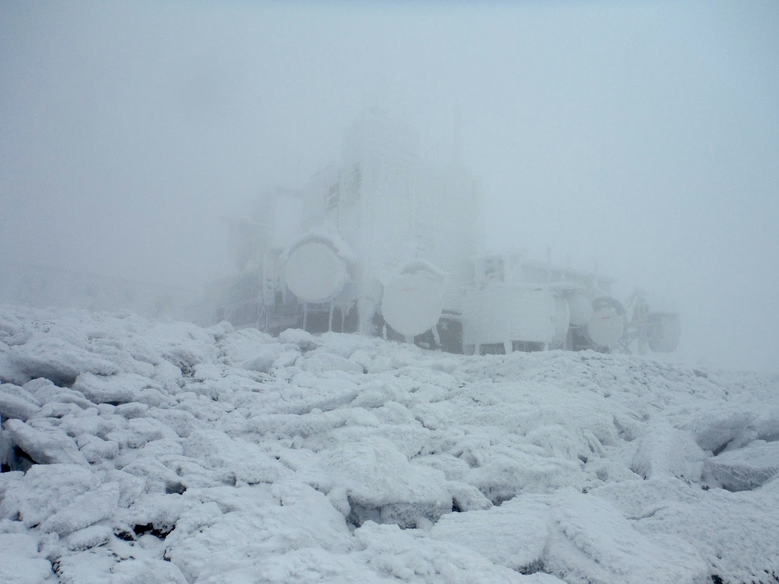
Soon after Jackson is the Mizpah Hut, a very strange building to come to in the dead of night.  It looked larger than the Madison Hut in the northern Presidentials that I had seen earlier this year, but then again, things look different at night anyway.

Mizpah Hut
The cold started to seep into the air around here.  Rime ice was present here on the tips of the krumholtz needles.  You don't mess around with mountain weather on the shoulder of the hiking season.  I remember hiking Franconia Ridge last October and it was very wintery, rime, snow, and a cold brisk wind making it unpleasant for stationary activities.

Rime ice on the needles
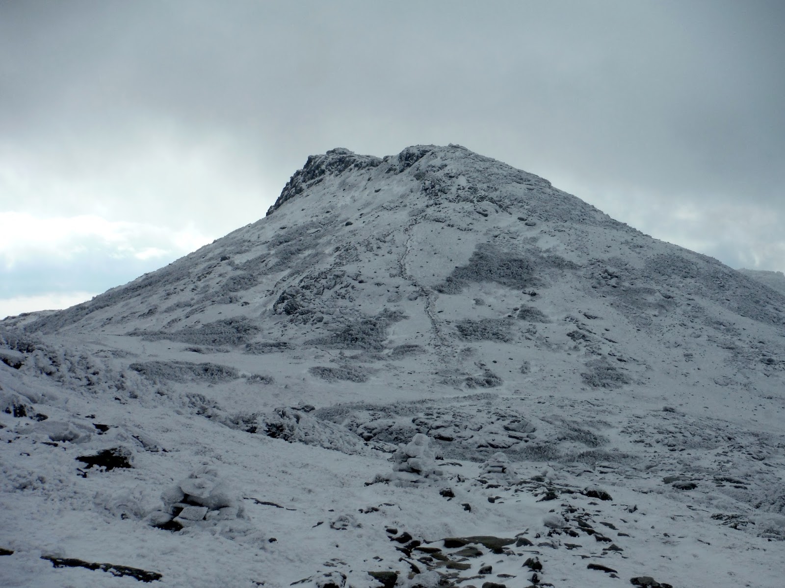
I missed a picture of the Mt. Pierce summit, primarily because I didn't realize I had passed it.  (Again, no summit signs in New Hampshire...hint hint AMC trail crew.)  Mount Pierce stands at 4310', my second 4000 footer of the day.  Around here, I broke tree line and the winds really picked up, as did the clouds/fog.  I was worried that I was not going to be able to find the trail because of the think fog, but the trail was lined with rocks on either side, making things easier.

In the section between Pierce and Eisenhower, I first began to see the first light glowing to the east.  When you've been hiking for a number of hours in the dark, this is truly a magical experience.  Near to the sun at this time of year are three planets.  A conjunction like this is pretty neat, especially with an adventure happening partially at night.  Venus is visible at the top of the frame below, as it Jupiter, just above the cloud bank.  Mars is in there somewhere, though I doubt it came through with this much pre-dawn glow visible.

Pre-dawn glow, with Jupiter and Venus, 5:46 AM
It is staggering how quickly the sky changes around this time.  Only ten minutes later, and the sky is almost twice as bright.  Venus is still sticking around, even with this amount of light.

5:53 AM
6:04 AM
This is my prized morning shot of the day.  The tiers of mountains that lay to the east are visible here.  Life felt real.  There is something very immersive about witnessing a change like this happen.  Taking in large breaths of genuine mountain air as the sun comes around the corner of the Earth to greet you - nothing quite like it.

6:14 AM
6:29 AM
Because nature hates me with a passion, I got this for the sunrise.  Gosh darn clouds once again.  It got very cold and windy.  I got to Eisenhower summit, but my picture of it was crap, so you'll have to take my word for it.  Mt. Eisenhower is 4780' tall, the last of the sub-5000 peaks for the day.

Chilly on my way to Mt. Monroe, 5371'.
Due to the clouds and other mountains being in my way, I didn't see the sun until about an hour after official sunrise.  It made its appearance, and it was beautiful.

7:21 AM, the sun is visible!
The trail down from Mount Monroe is one of the most pretty trails I've seen in the Whites, in fact probably across the board hiking.  Easy to walk on?  Not so much.

Descending Mt. Monroe to Lakes of the Clouds Hut
At Lakes of the Clouds, I was actually given a view without too many clouds!  Below is Mt. Monroe, where you can really see the drop-off to the eastern side.

Lakes of the Clouds
I took a small break here and enjoyed the view.  The sun was high enough to reach into some of the more western White Mountains.

Me being peaceful, or maybe just avoiding being blinded.
I worked my way slowly up to the highest point of the day, Mount Washington, at 6288'.  The perspective of mountains as you rise and fall along a ridge is interesting.  From cols or saddles, mountains don't seem quite as large as they are.  About halfway up (or down) from a col to a summit, the one across the saddle looks menacingly large, especially if your legs are worn out.  If you are on the taller side (like the picture below), the smaller peak appears to diminish to much smaller than it is. Only 1000' shorter than Washington, Mt. Monroe appears minuscule, and I still have a fair climb ahead of me to the summit.

Mt.  Monroe behind me as I climb Washington.
My prize for the day was not having to wait in line at the summit of Washington.  In fact, I arrived at 8:50, before the park actually opens.  I was sitting down and munching as the park employees rumbled up in their silly SUVs.

Mt. Washington at 6288'.  My third summit of this mountain.
On Washington, I took a substantial break to eat, as well as to take a nap.  I went to the leeward side to escape the winds, and found a nice rock to stretch out on.  The sun's warmth was appreciated after a cold and windy trek along the ridge for a few miles.

I woke up a few times to people walking up the staircase speaking foreign languages, and it reminded me of how easy it is for people just to travel in from absolutely anywhere and drive up the mountain.  That's what I don't like about Washington.  A place like this is special, and I'll be honest, it ruins the experience for me a bit to see hoards of people up there.  Luckily, an early summit can avoid the worst of it.

The northern Presidentials: Clay, Jefferson, clouds, clouds, etc.
It was here that I made the choice to get my act together and do a FULL traverse of the Presidentials.  This was a hike I had been wanting to do for over two years, and I figured why should I wait for "the perfect time" to do it.  Now was perfect - I was here, and half of the mountains had been hiked already, with still three quarters of the day remaining.

I filled up my three water bottles and headed down the north slope of Washington toward Mt. Clay.  I stupidly made a wrong turn before Mt. Clay and went around it instead of over it, but I suppose my legs appreciated the slight break from up and down all the time.

Next up was Mt. Jefferson, standing at 5712', the third highest in the state.  I saw a few people here on the summit, and these were not far from the first people I had seen all day.  I saw one fellow going along a different trail around Lakes of the Clouds Hut, and then several around the summit of Washington.  I stopped here at Jefferson for a snack (carefully rationing out my remaining food, as it was around here I realized I didn't have as much as I would have liked), and thought long and hard about Mt. Adams and Madison, the two peaks I had left to complete my traverse.  Adams is a very large mountain, even from Jefferson, standing at nearly the same elevation.

Mt. Adams from Mt. Jefferson
Mt. Adams made for a very slow summit, as my body was starting take in the reality that I was attempting a 20+ mile hike on zero sleep from the night before.  With some musical motivation from my ipod again, I made it up to the the second to last peak.  I also met a south-bound AT hiker, Mountain Man, a nice guy to chat with.  Mountain Man had recently passed another hiker from Maine. and suggested that I might be able to snatch a ride back to my starting point with him, since he was parked at Jefferson Notch, planning an out-and-back to Jefferson, Adams, and Madison.  That solved my potential downfall to a traverse without having planned logistics for each end.

I had saved my last of three sandwiches for Adams, since I knew that was the last big push on the traverse.  It was amazing.  A small frog would have been amazing as well, but the sandwich was great.  As were the wheat thins.

Viewing Mt. Washington from Adams.
It is important to look both ahead of you and behind you on such a hike. The progress you've made is a powerful motivator in times of discouragement and tiredness.  Not to mention the utter beauty of a range like this.

Here is Mt. Madison, the last of the peaks on the traverse.

Mt. Madison, 5367' from the shoulder of Mt. Quincy Adams
(sub-peak of Adams)
I got to the Madison Hut (just visible in the photo above), and prepared myself for the last mountain of my traverse.  Both a very happy and sad concept.  It was absolutely spectacular to have spent the entire day in the mountains, mountains that I very much care for and would be sad to leave.  At the same time, my body, pleading for a rest, was happy to see the last peak in sight.

Looking back toward Washington and Adams, and all the mountains that lie behind those, it is a true look at the ruggedness of a hike like this. The rocks in the northern peaks are more demanding than the bog bridges and forest paths of the southern ones.

Washington (left) and Adams (right)
I made the summit of Madison, the final high point on the hike!  I know there is a whole mountain to go down, but I paused here to take in the view to the north, finally unobstructed by more peaks to conquer.


Descending along Watson Path, which would lead me to Appalachia, the northern terminus of the traverse, brought with it challenging terrain of sharp rocks and hard-to-find cairns.  I put on my mittens purely for protection from the rocks I was using as hand holds.  But soon, I found these funny things called trees!  I had forgotten about them after so many miles above the tree line.  They also make good hand holds for swinging down the steep terrain safely.


I saw a few people along this trail, eventually leading to Valley Way trail. I stopped at a stream crossing to refresh myself with some water. Knowing that I was only a few miles out from completion, I got myself up again to descend the last bit to Appalachia.  Perhaps due to too many hours awake, I ended up on Brookside Trail, which parallels Valley Way, and...you guessed it: follows the brook.

Just a few minutes after 16 hours elapsed time, I crossed the power lines that indicate the end in just steps away.  The evening light was passing through the corridor as the sun was on its way over the horizon, having done its work for the day.

Appalachia only a few steps away...
At the parking lot, I met a cool dude waiting to ascend the Airline trail for a night hike that evening.  A seasoned hiker and backpacker he was, and we talked about his experience in SAR and thru-hiking on the AT. And because I feel I should tell you, he very much recommends Sealskinz gloves for winter hikes - fully waterproof and windproof.  I tried them on, and they super easy to slip on.

I added up the mileage of the day as I waited for my ride from Andy, the friendly hiker of Jefferson, Adams, and Madison.  The total on the map came out to 24.2 miles, which, if correct, would break my previous record of 21 miles in Canyonlands NP with the one and only Noah Pappano.

Here is an annotated elevation profile from caltopo.com (Caltopo is an online database of the USGS maps, completely open-source and searchable like google maps.)


Hike Data
Miles hiked: 24.2
Time elapsed: 16.1 hours
Total ascent: 8920'

This brings my hiking total for the year up to 300 miles since January 1, 2015.  Hopefully many more before the year is out.  If you're wondering how exactly I made it back home, it was a long a painful journey involving a car-nap and some caffeine.  Totally worth it for a Presi Traverse though.  What to do next though???

Saturday, June 20, 2015

Northern Prezi Traverse (AT1Day)

I've taken a short hiatus from posting on here for a few reasons.  One, at the end of my road trip, my dear Wombat bit the dust in Sheridan, Wyoming, and that kinda took it all out of me for awhile.  After catching public transport home over the next week, I was focusing on the fact that I was back home after 2 months on the road, and finding a place for all the stuff I had brought back with me.  I didn't want to relive the less-than-great ending to my trip again, so I avoided writing about it.  However, I am back to write about a delightful hike I did since returning to Maine.

While I was stuck carless in Sheridan, Wyoming, I came across an event that was taking place along the Appalachian Trail on June 20th, the world's first attempt to have all of the AT hiked by someone over the course of 24 hours.  Each person signed up to hike a segment (or several depending on length), but there were no rules saying more than one person couldn't do the same segment.  I chose to take the segment in New Hampshire from Pinkham Notch to the Mt. Washington summit. The AT goes the long way to the summit, first hitting the rest of the northern Presidentials (Mt. Madison, Mt. Adams, Mt. Jefferson, and Mt. Clay), which comes out to about 12.5 miles.  (Technically speaking, the AT doesn't summit each of those, but I took the loops up to the summits that weren't along the AT for extra bragging rights.)

Because I had such a long day planned (12.5 miles plus the mileage of whichever route I took down), I thought it would be good to drive down the night before and camp, allowing for a super early start the next morning.  On the evening of June 19th, I got my hiking gear, food, and water together for a late night drive out to New Hampshire.  It was great to finally be doing it for real, since I had felt the tug of the hills ever since returning to Maine.  The breeze through my bedroom windows at night was a nostalgic sensation of being out in the mountains last summer.

After a slightly tiresome but still enjoyable 3.25 hour drive to Pinkham Notch, I arrived in an already mostly full parking lot.  Last summer I had heard of a neat place to stealth camp in Pinkham Notch called Square Ledge, a short trail up on the opposite side of the valley as Mt. Washington with a flat rocky top.  With a perfectly clear night in the forecast, I was planning on sleeping under the stars that night.  The climb up to the huge ledge was pretty short, and filled with spiderwebs in my face.  Upon reaching the top, I saw a few tents expertly nested between the trees, but that was no worry since I was going front and center to the middle of the ledge with my sleeping bag.

It was just shy of 1am by the time I got set up, but I was still torn between looking up and the millions of stars or trying to get some rest. After seeing a shooting star, I fell into a sleep of sorts, planning to get up at 5am.  Instead, I was awoken by a large black thing coming at me. I thought it was a hungry bear.  But then I saw it had a red headlamp on, which most bears do not.  There was a sequence of screaming between me and the not-bear, as I realized this was a human that had gotten up at 3am to take in his camera that was set up to catch the Milky Way that night.

I tried and failed to go back to sleep at this point, and figured why not just hike down to the car, get some breakfast, and start hiking. Breakfast consisted of stuffing as much food in me as possible as well as stuffing as much as I could fit into my backpack for later.  I was excited to be bringing along some BBQ kettle chips, which are my new hiking staple.

The trailhead at 4:08 am!
Aside from more spiderwebs catching my face since I was presumably the first person on this trail for the day, it was pretty easy to follow with some headlamp assistance.  I stopped by Lowe's Bald Spot, about 2 miles in, but a peek at the brightening horizon.


Lowe Bald Spot was just inside the Great Gulf Wilderness, which allows nothing mechanical, no motorized vehicles, no bikes, and even no chainsaws for trail maintenance.  All blowdowns were taken care off with AXES, which I thought was impressive.

A few more miles and the sun came over the horizon to greet me.  I consider this my summer solstice sunrise since the actual solstice was cloudy and rainy.

The earliest visible sunrise of 2015
Crossing a branch of the Peabody River is this nifty cable bridge.  It's along part of the Great Gulf Trail, which the AT shares for a bit.  This bridge wiggles when you walk on it, so other hikers, you have been warned.


The Osgood Trail I believe is what took me up to the tree line from the bridge, and despite having hiked many steep trails in the west, I think my legs forgot what steep means in the east.  Breaks were frequent, but the views behind me as I rose quickly were very rewarding.  Soon, I broke tree line, and let me tell you, to see bluebird skies over the Presidentials was quite a gift.  I'd be inclined to say it's the best weather Mt. Washington got and will get all year.

Mt. Washington (left) and Mt. Clay (right)
Going slowly to make sure I didn't lose my footing on the gnarly rocks up here, I made it to the summit of Mt. Madison, at 5367.

Summit of Mt. Madison.  Washington, Clay, and Adams in the background.
Mt. Washington is still over 6 miles away.
After many Wheat Thins, I continued to the next mountain on the list, Mt. Adams.  There is a silly hut at the col which allows people to stay there and cheat at summiting.  (Hey I admit they are probably really nice inside, but it takes the wind out of your sails when I was hiking since 4 in the morning and you arrive halfway through a summit party.)

Here is Madison Hut.


One thousand feet up is Mt. Adams, at 5774.  The second highest mountain in the northeast, and the highest one without a road.  I could see Mt. Madison behind me, and it looks like a mere pimple compared to Adams.


More Wheat Thins and slightly dipping into other snacks, I continued down into the second col, making my way to Mt. Jefferson.  Along this stretch is when I walked along the only snow on my route for the day. There were a few patches elsewhere on the range, but not on trails that I could see.

Snow on the way to Mt. Jefferson
The summit of Mt. Jefferson (5712) was crowded like all the others.  I just sat off to the side and replenished all the darn calories I was burning off.  It was around now I was starting to feel the effects of all these rocks on my feet.  Rocks are very solid compared to a soft forest bed, and after a number of miles, it gets achy on my feet.

After Jefferson was Mt. Clay, which I don't believe is counted on the NH48 since it isn't prominent enough, but it's still worth going over it instead of around it unless you are boring.  It is pleasantly rounded which is a nice change from pointy like the others.

Mt. Clay (5531), with Mt. Washington (6288) getting closer.
The trail crosses the Cog Railway that ascends Mt. Washington.  As I was going past it, a train was coming up, so I waited a minute for it to pass, which was awesome.  The steepest part of this track is 37° from the horizontal.  Which is very steep.

The purple train.  (There was orange, and yellow too)
Nearing the top of the mountain, I could look back and see all the mountains I had come from earlier today.  From left to right, we have Clay, Jefferson, Adams, and Madison.  These are the northern Presidentials, and in the best of weather today.

The northern Prezis.
Some people call the summit of Mt. Washington a zoo, and they are right.  It is a zoo for hikers.  People come here in their cars to see hikers in their semi-natural habitat.  Because of this, the line to take photos at the summit is unbearably long unless you are lucky with timing.  I arrived at the end of the Mt. Washington Road Race, and there was effectively a party on top.  This was as close as I dared to get to the summit sign. (Personally I think hikers should have their own separate sign to help reduce the congestion, or drivers just don't get to have a summit photo by law.)


I spent a good hour on top, with some delicious tortellini with pesto.  I spoke with this older gentleman who sat next to me on a bench, and he had driven up, but he said he had been all up the Maine coast recently, so of course that was a hot topic on conversation.  I decided during my extensive break that I would take Lion's Head Trail down to Pinkham Notch since Tuckerman's Ravine was still partly closed due to snow.

The Boot Spur was clear on the east side of the mountain, with the cairns as small as pebbles from this high up.

Boott Spur, the way I descended last summer.
Because I am such a rebel, I avoided the traffic jam on the trail and made my own which cut off a little bit of mileage to the Lion's Head Trail. This is a neat trail because it goes along the northern edge of the Tuck's Ravine.  From this vantage point, I could see some late season snow left over, but impressively, with ski trails down it still.  Someone was determined to ski very late in the season.

Tuck's Ravine with snow
I had restored my feet some while resting on the summit of Mt. Washington, but after several thousand feet of descent, and not on a gentle slope for that matter, the pain was back again, and I had to try very hard to distract myself from it.  I followed and eventually passed some people who were hilarious to listen to as they struggled down a nicely made staircase of rocks (thank you trail crew!)  I caught up with some guys who were going about my speed, and we talked about ideal places to hike in western Maine, since they were looking for some suggestions.  This broke up the rhythm for awhile, and we took a break at Hermit Lake Shelters for H2O.  I continued ahead of them from here along the very rocky Tuck's Ravine Trail, several miles back to the parking lot.  I was super excited whenever I saw some gravely patches on the trail, because that meant not hobbling over rounded rocks.

The timer read 11:07 when I got back to the Tuck's Ravine trailhead.  A very long day, despite starting at 4am.  I did some math on the map afterward, and the total mileage was 18.6, which isn't breaking any records, but it certainly felt like an accomplishment, having done 5 summits over 5000 feet in a day.  From the parking lot, I could see Square Ledge, where I spent several hours attempting to sleep the night before.  There is a human in the lower right corner if you zoom in enough.  He may be rock climbing, since this is a popular place for such activities.

Square Ledge, my favorite place to sleep in the world
Google Earth always makes an appearance on these trip reports, so here is the track and elevation profile of my hike from the northeast perspective.   The record I did break on this hike was the amount of vertical gain in one day, which comes out to 7500'.  I will forever feel lucky to have hiked this range in such good weather.  I should mention I had the thought of going all the way along the Presidentials to do a full traverse, but my feet were saying "no, no, no, no.  (no.)" by Mt. Washington, so I left it for another time.  Perhaps if weather is good, it would be easier in the winter because you don't have to deal with all the uneven rocks with snow cover.

Google Earth track and elevation profile
Hike Data
Miles hiked: 18.6
Time elapsed: 11.1 hours
Total ascent: 7500'