Showing posts with label north carolina. Show all posts

Sunday, May 25, 2025

2025 Road Trip: Part 4 (NC-AR)

North Carolina to Arkansas
and a Tornado Warning?!

Day 4
5.25.25

All intentions of getting an early start to accommodate the miles we hoped to cover this day failed miserably. Turns out it feels good to rest and sleep in a bit, so the waffles became more of a brunch meal. We enjoyed them with various toppings, Yilin taking a particular liking to the crispy waffle.

A tribute to Union College's "Waffle Tuesday" events

Benny's mom had specific instructions that anyone that visits the house write in the journal (the latest of a whole stack dating back to 1999), so we made our contribution on, sharing thoughts and musings of our visit, and a few tiny illustrations as well, for good measure.

After filling up our big water tank and trying our best not to forget anything, we were on the road just before 2pm, with hopes of getting to Arkansas by the end of the day. This would mean not meandering around nearly as much compared to the first few days. The plan was to get on US-64 toward Chattanooga, follow I-26 for bit, and then follow US-72 through the northern tips of Alabama and Mississippi, which would add new states for me. Past Memphis, we'd be on I-40 as I'd found some dispersed camping sites within the Watensaw Wildlife Management Area not far from the highway.

Now I've had an idea that I wanted to have some fun with on this trip, which was supposed to be a set of bingo sheets for various categories of things we see along the way, but due to my last minute preparation nature, it still sits as a list of items to be checked off on my phone's notes app. The category that I'd like to feature today is "Unusual Modes of Transport", on which I've listed a split windshield truck (shout out to my dad who loves these!) I've actually seen a few of them on the trip, despite their relative rarity, but we spotted a great one on our way out of Franklin this day, that seemed to have been taken over by plants in the bed as well as in the cab.

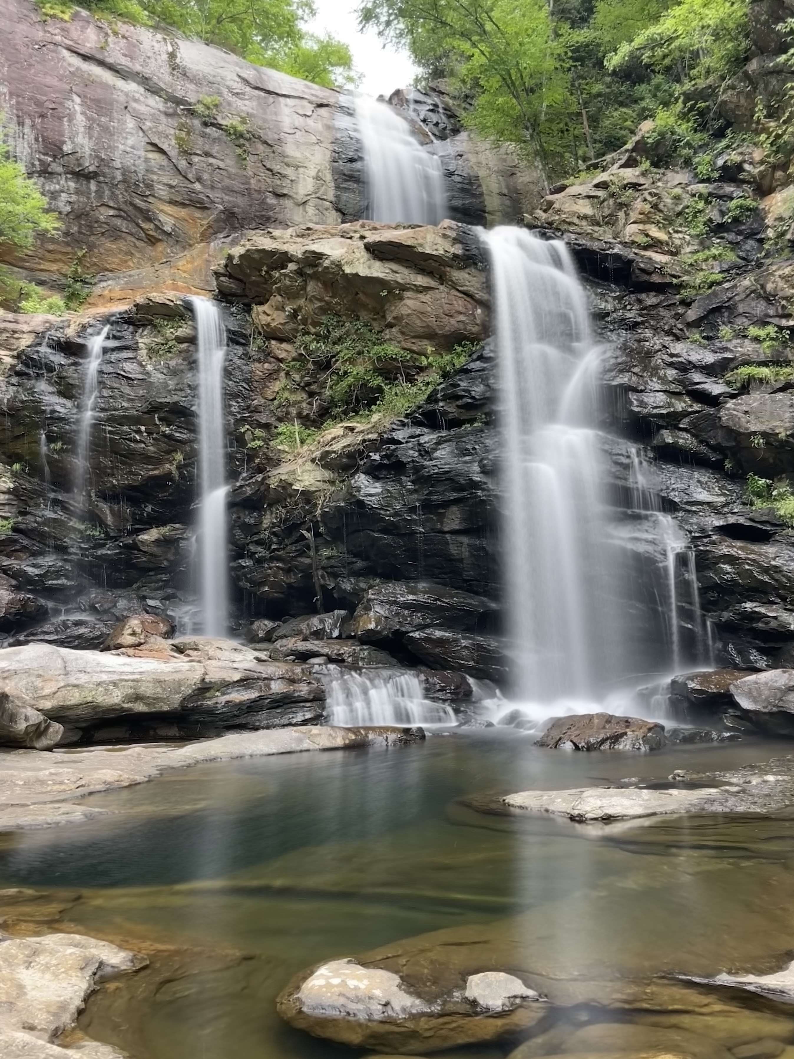
Out of town, now on US-64, we wound our way through the mountains heading for the Tennessee border again. The weather was comfortably cloudy—no baking in the car for now—and at a scenic pullout, we switched drivers for a bit so Yilin can get her practice in to prepare for her upcoming license test, and also so I can look around and take pictures.

US-64, western NC
This was a great driving road, without much traffic at least when we passed through. Once in Tennessee, we came up to Lake Ocoee/Parksville Lake, which was booming with rafting and tubing activity, it being a weekend day after all. So many repurposed school buses passed us with a huge stack of inflatable rafts strapped on top, returning them from river trips that local companies offer.

While passing through Chattanooga, I-26 briefly dips into Georgia, but interestingly, if you like highway trivia, this is the only place in the US where an interstate highway crosses a state line but does not restart the mileage markers. The detour into Georgia is so short that they must have made an exception for this special case. Either way, I'm adding Georgia to our states list!

Another bingo category to mention is "Interesting weather/space phenomena", where by this point of the trail several items have been checked off. We saw crepuscular rays on Skyline Drive in VA, a double rainbow just before finding our campground for the first night, and now on our way to Alabama, we received a tornado warning alert our phones. For us, I think that's good enough and there's no need to witness a real tornado, as we're no professional storm chasers.

I was monitoring the weather radar and our map to see what we might expect along our planned route, or if any modification was necessary. US-72 was headed southwest out of the heaviest patches of rain, so we thought it would be safe enough to continue on. The sky however darkened and the wind became so strong from the north we saw huge flocks of leaves flying off the trees horizontally. Within minutes the rain came down in torrents, and even the fastest wiper speed couldn't keep the windshield clear, so I pulled into a gas station with many others doing the same, planning to wait out the storm until the worst part passed.

The sun came out shortly after the front passed overhead, and we were on our way again. We passed Huntsville and Decatur before we started to see another massive dark cloud coming our way, so our thinking was to pull over before this one and prepare a quick dinner roadside from our coolers before getting dumped on for the second time. We made it to Cherokee, AL for our pit stop, and from there the sky became extremely dark and ominous, and before long impossible to see due to the rain. Here's some dashcam footage showing our approach into the storm. When you see everyone's hazard lights on, it's because a huge tree fell into the road and blocked one lane.

The weather thankfully cleared on approach to Memphis, though by this point it was around 10pm, and there was still 90 miles left to go, so after a quick gas stop, we pushed onward through a sea of semi-trucks. After passing the White River in Arkansas, we took our exit to the WMA where we'd be camping. In my research, there were plentiful pulloffs on the gravel road we were headed down, all marked with blue paint on tree trunks, but in a dark, soaking wet forest, unless it's right on the roadside, they're invisible, so I ended up missing a bunch of them, but eventually found one a few miles in at midnight. No competition for a spot here on a soggy night, but there was a dry spot slightly raised enough for our tent. We rushed to set up the tent in case a bit of rain decided to sneak up on us, but thankfully it was just a few drips from nearby trees. Sleep came easy as we had had such a long day on the road.

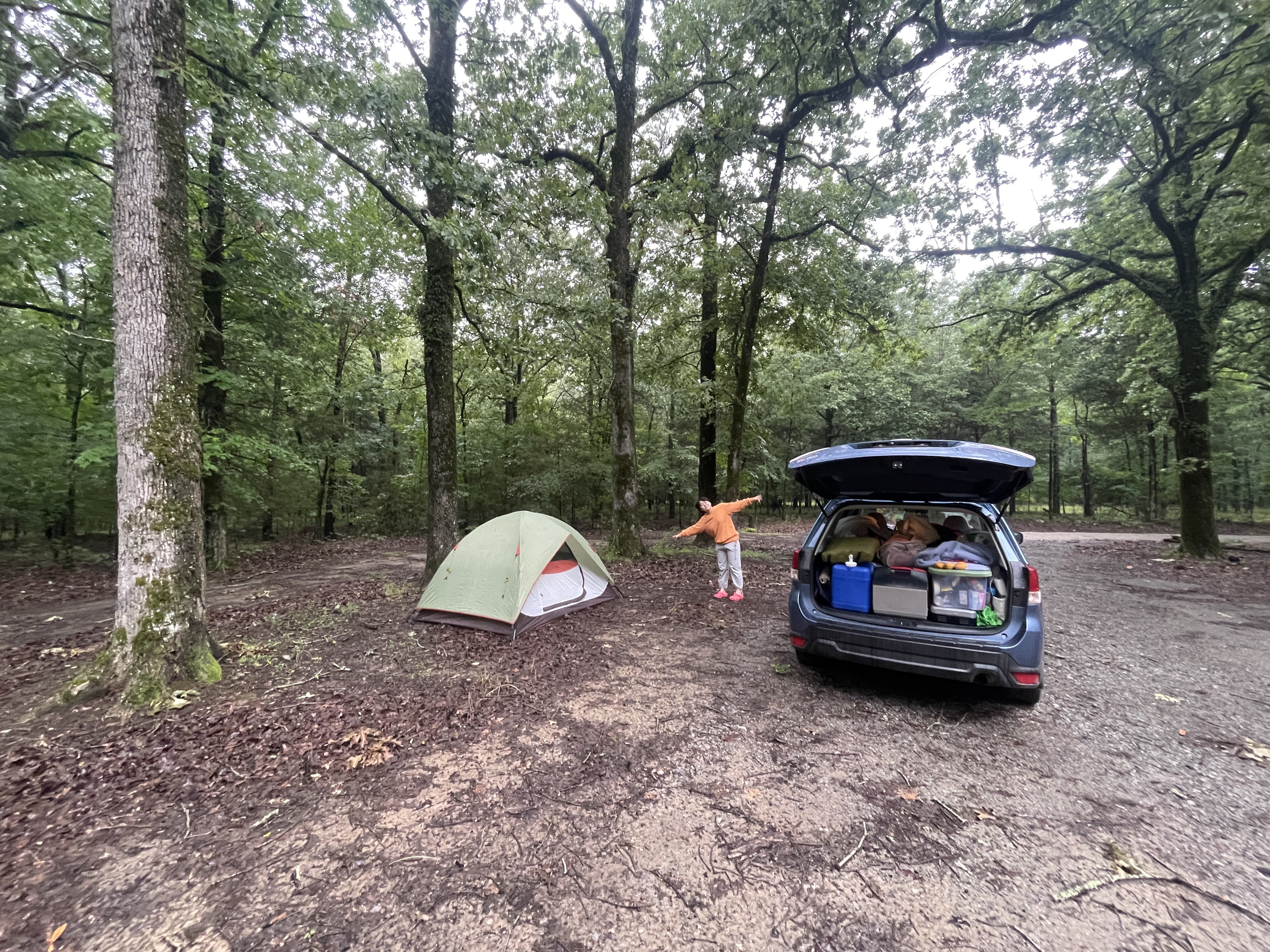
Our Arkansas campsite from the next morning when you can actually see it

Our plan for the following day was to make it 360 miles to Dallas to meet with our friend Emilia and eat some Texas BBQ, and then we'd be staying in Dallas for a couple nights to explore the area.

Day 4 Route map: 562 miles
Total mileage: 1329

Saturday, May 24, 2025

2025 Road Trip: Part 3 (Franklin NC)

Franklin, NC

Day 3
5.24.25

Feeling well rested after a night in one of the cozy bedrooms of Benny's mountain house, we had a minor complication to our original breakfast waffle plans, that being the clear absence of a waffle iron. Benny wanted to make waffles with me since the two of us used to host a waffle event at Union together, every Tuesday night after my orchestra rehearsal, and it was always a big hit with the eccentric crowd there.  He was confident there was a waffle maker at the house before heading up, but we couldn't find it, so agreed to grab one from the store in town and do it the following day. Instead, he cooked us some traditional corn grits to get that full southern experience (his words).

Next was to head downtown and see what the shops had to offer. Since Franklin is right along the AT, it's no surprise that there is an outdoor gear shop here to cater to that crowd, as well as any other mountain activity lovers living there or visiting town. I had to be dragged out of the map section as usual. Next, we explored a vintage/antique shop that had many bizarre items for sale including rare specialty tools that Benny was eager to test my knowledge on, disturbing animal sculptures, limitless chicken and cat themed items, oversized drill bits, a frog army, old signs and license plates, even a "man cave" sign which I was tempted to buy until I saw the asking price. Instead, Yilin found two tiny wooden cats that look like hers (Erik and Watson for those who haven't met them).


It was a farmer's market day, so a number of tents were set up nearby selling various goods, and we happened to spot one vendor holding a tiny kitten in her arms behind the table. As Yilin went to get a closer look, a lady from the next tent asked if I was interested in any of her tomato seedlings. I said we were just checking out the kitten, and she said there's 8 more she's trying to get rid of??

Our kitten friend from the farmer's market

After wandering the shops a bit, we picked up a waffle iron from a surprisingly nice kitchen supply store, and stopped at Rathskellar Coffee Bar and Pub, where Yilin tried Ginger's Revenge, a blueberry flavored beer with a gingery aftertaste (so I'm told).

Benny drove us east to the trailhead of a waterfall hike nearby, locally known as High Falls. He told us there's a longer but flatter trail, or a shorter and steeper one, which he hadn't tried before. We went with the latter, which despite starting at a lake, was a downhill hike first. Once there, I finally realized the waterfall is supplied from an outgoing stream below a dam, not an incoming stream, explaining my confusion looking at the map earlier. The trail wasn't so bad at first, but soon was a steep stone staircase of boulders, descending over 700 feet in a mile or so.

Approaching High Falls

Roommates!
Upper falls

The falls has an upper section and a lower one, and as you hike down, there's an opportunity to view both, as well as rock-hop over to the opposite shore and sneak back to the upper falls as well. We did all of this, and Yilin while testing how slippery the wet rock was, discovered it was indeed quite slippery and dipped a shoe into one of the small pools. Only one toe got wet thankfully, and nobody was harmed in this experiment. Benny found a couple salamanders chilling with some tadpoles in small pool off to the side, and was brave enough to stick his phone camera underwater to get a picture.

"Science"

High Falls (Cullowhee Falls)

We climbed back up the stone steps, Benny occasionally identifying various types of mushrooms we spotted along the path. Next on our agenda for the day was to grab a few things at the store for a fried rice dinner, and I saw some fresh looking Brussels sprouts I couldn't resist, so we planned to roast those up as well that evening, while Benny fried up the rice on a huge outdoor griddle. With pleasant temperatures, we decided to eat on the screen porch and enjoy the fresh air. The biggest surprise for dinner was how convincing vegan scrambled eggs were. They are made from mung beans, and tasted nearly identical to any other scrambled egg I've had with fried rice.

Dinner together on the porch
(fried rice, balsamic roasted Brussels sprouts,
cucumber salad, and later ice cream)
Benny had intentions of folding some modular origami (our traditional pastime at Union) and possibly playing a few games of pool afterward, however we got too invested in looking through some old pictures I had saved from our time at Union, including a video of the fateful day I fell from a tree in an attempt to retrieve a stuck frisbee, captured by an unknown bystander. (As I recall, I had a sprained wrist for quite awhile afterward, which made an upcoming Taiko drumming concert much more painful.)

With our day full of interesting things coming to a close, we headed off to bed, excited to enjoy some celebratory waffles in the morning, after which we'd be heading west an a blistering pace to try to get some miles in.

Day 3 Route map: 50 miles (with Benny as our chauffeur)
Total mileage: 767

2025 Road Trip: Part 2 (The Channels)

Virginia to North Carolina
The Channels Natural Preserve

Day 2
5.23.25

Our second day of the adventure was to include an interesting hike I've had starred on google maps for a couple years called The Channels in southwestern Virginia, which is a unique hike featuring large sandstone blocks with deep crevasses or slots that you can walk through and explore like miniature city blocks. Today's plan was to rise relatively early, head over to The Channels, about 80 miles southwest, and then finish the day at Benny's family's mountain house in Franklin NC in the evening for dinner.

We were up by 6:45 and packed up camp, opting to have a quick snack along the road instead of unpacking the kitchen kit for a full breakfast to save a little time. As always, the distance to our trailhead seemed to take much longer than I had anticipated, however this gave an opportunity to do some cow-spotting, and considering the winding nature of the roads in the area, it took us about two hours to finally get to our parking spot. The Channels seems to be a hidden spot that perhaps isn't too popular, as there are a strictly enforced ten parking space limit here, seated atop one of the most intense paved mountain roads I've ever experienced in my life. This would be VA-80 of course, and the turns are so tight that it seems one might fall off the edge if you lose focus for a mere second. We saw a Jeep convoy headed down as we went up, so it seems to be a popular road for this community, and I second this rating!

Yilin and I got ourselves ready for the hike, packed some brunch in our bags, and headed up the old road that leads into the preserve around 10:30. I had downloaded the AllTrails map beforehand as I usually do, however it wasn't super clear where exactly along the trail the main feature of the hike would be, and I thought it was about 2.5 miles in, with a fire lookout tower at the end of the trail. The trail begins along an old gated road bed, however several cars did drive up past us to some cabins that are hidden up in the mountains here, so they must get special access to drive here if renting one of the cabins.

Trailhead for the Channels hike
Past a rustic cabin property, the trail becomes narrower and only allows foot traffic, snaking its way up the side of the mountain with some switchbacks. We chatted with a couple coming down with their dog and asked where exactly we could encounter the main "channels" area, and they informed us that it's actually a short walk beyond the fire tower, and the tower itself is no longer open. This added some mileage to our original plan, not the greatest news for Yilin who had mentally prepared for a shorter hike based on what I had known about the trail before....oops.

Bench #2 of 3 along the way
It's important to note that hiking is very much more my thing than hers, and she prefers a museum adventure in most cases, so I may or may not have been threatened with some museum trips in the future. Finally we saw the sign for a short spur trail that leads up to the summit area with the disused tower and the channels. Turning the corner, we saw a tower with the lowest set of stairs removed to dissuade people from attempting to climb it anyway, despite no floor on the cabin above.

Fire tower sadly closed and unclimbable :(
Continuing just a minute further, we saw a small sign indicating the Channels, with a small viewing area to the left on the top of one of these stone towers. It was chained off, and rightly so, since the crevasses between the field of towers while narrow, are 30-40 feet deep, and a misstep would be very nasty here. Going instead to the right will descend into the labyrinth of narrow passageways. This was amazing, and definitely beyond what I had expected, even having seen some pictures posted online! It's not large enough that you'll get lost inside the maze, but there are some small arrows pointing to the way out if you do get turned around.
Inside the labyrinth of The Channels


We found a small clearing to enjoy our brunch before winding our way back toward the tower and back down to the trailhead. The way down always seems to feel longer even though it takes less time to descend...we made it back by 3pm and decided that we'd go for the fastest route along the interstate to the mountain house in North Carolina in the afternoon so we wouldn't arrive too late. I had asked Benny to curate a list of things for us to do together in the Franklin area, and he suggested a local fire tower hike that he's done a number of times before when visiting the mountains. Due to my misjudgment of the hike length though, we'd be getting in a few hours later than expected, so Benny suggested we meet directly at the trailhead and then convoy back to the house afterward. He nonchalantly texted me mentioning that the access road would be gravel, which was no concern after yesterday's adventure up the crazy "road".

After snaking our way down VA-80 to Meadowview, we got our second jaunt of interstate on our trip, blasting (relatively speaking) down I-81 toward the Tennessee border. We stopped at the welcome center for a pit stop and free map, and noticed some musical notes painted on the sidewalk every few feet, which I found quite entertaining! It reminds me of a rhythmic training exercise I might do with some of my younger students.


We wound through the Smoky Mountains on I-26, climbing to a pass at the TN-NC border, and enjoying endless mountain views in all directions. I think we spotted North Carolina's high point Mt. Mitchell just to the east in the distance at one point, perhaps a future trip and I can go hike this one. Back into the valley we passed by Asheville, which likely deserves its own visit one day as well, but this of course is the one downside of any road trip - you have to decide what to stop and see and what you may have to skip, since seeing everything is impossible. As the sun got lower, the twisting mountain roads were in and out of the shadows, causing us to constantly adjust sunglasses and the car visors around every bend. Finally, after crossing the Little Tennessee River at Tellico Bridge, we found the winding road up to Wesser Bald Fire Tower, whose trail is actually is short portion of the Appalachian Trail.

The pavement ended and we followed the power lines up to a steep mountain pass with switchbacks for something like 7 miles. Somewhere along this stretch, we passed the largest corkscrew sculpture I've ever seen. Further up, recent rains had even caused half the road to collapse into the abyss in one spot—along with one of the warning cones placed there to warn drivers. I was wondering if I'd be able to get up this road without a Subaru honestly, but the AWD got us up no problem, and at the top we spotted Benny there waiting for us with a picnic bag, surprising us with dinner packed for us to eat at the top!

Who needs the whole width of Tellico Road anyway?
Here began a reunion after a decade, since the last time we had met up was interestingly on my 2015 road trip, where I stopped in at Union College in NY to visit. Once again, we put hiking shoes back onto our tired feet, and tried our best to keep up with Benny as he fired questions at me to catch up on ten years of history since we last saw each other. I guess we should keep better in touch?

Our timing ended up being impeccable, as once we rounded the top, the sun was just minutes from sinking below the endless sea of mountains. Visibility was about as good as it gets, with an orange sky to the west and a deep blue to the east, and small lakes dotting the valleys below. We decided to eat our picnic below the tower due to a chilly wind, exchanging fun stories of our time together at Union, and what had transpired in each of our journeys since then.

Sunset at Wesser Bald Fire Tower

We descended by headlamp, and followed Benny back to the house, where we received a grand tour. Built with timber-frame construction, I instantly took a liking to the style, as it blended the framework of my family's barn with an interior featuring plenty of natural wood, not unlike the cabin I grew up in once moving to Maine, as well as a living area open to the second floor. Benny's family built the house when he was young, and shared some pictures from the construction process hung on the wall, along with a raised topographic map of the area in the stairwell. Many bedrooms lined far ends of the house, with a huge kitchen designed for feeding the usually much larger crowd that visits the house.

The beautiful mountain house!
A screened porch and open deck hung off one side, both of which we made use of the following day to get some fresh air while eating and cooking dinner. For now, we discussed some options for how to best spend our day in Franklin, having opted to spend two nights there. Our general plan was to explore the quaint downtown area shops, check out a local waterfall, and spend the evening cooking dinner together.

Day 2 Route map: 314 miles
Total mileage: 717