It was recommended that I check out Borestone Mountain by a Karen, one of my coworkers at EBS. First off, I was excited to hear of a new place in Maine I hadn't been to or even read about somewhere previously. A quick check in the Maine atlas brought to my attention a few more interesting places nearby that I could likely explore over the course of a two-day weekend...
So Borestone is a sub-2000 foot mountain in the Elliotsville Plantation, and perhaps because of its relative shortness compared to the famous 4000-footers like Katahdin, Bigelow, Sugarloaf, and Old Speck, it is often overlooked as a hiking destination. It was by me at least. But it shouldn't be, because it's a great (and pretty challenging) hike with nice vistas and well built trails. Also, I should make known the presence of the three small ponds halfway up the mountain, or tarns, as I should be calling them: Sunrise, Midday, and Sunset Ponds.
Here is a view of Borestone from Barren Mountain to the north. The eastern face of Borestone is craggy and steep, giving the impression of a high perspective over the valley. This is especially nice with a partially bald summit.
 |
| Borestone Mountain |
To access the parking area, you're going to be coming up the Mountain Road from Willimantic or Elliotsville Road from Monson, and right past the bridge over Big Wilson Falls, you drive up the east side of the stream on Mountain Road and the parking area is after the train tracks on the left. The trail begins on the right side of the road and doesn't hesitate to begin climbing almost immediately with lots of shale steps built into the hillside.
You can either walk up the road or take the trail, since they meet up at the ponds, where I believe you can rent some rooms in a lodge. I took the trail, which winds a bit more uphill through the forest. I stopped halfway to the ponds at an overlook on a side trail which crosses the road downhill a short distance.
 |
| Trail network from mainetrailfinder.com |

I continued past Sunrise Pond to the east where the trail soon began its very steep section of steps up to the summit. The pond is just visible through the trees as you gain elevation, but soon you find yourself focusing on how such a small mountain can be so challenging. The trail comes to a big rocky outcropping that is steep and includes iron rungs for assistance (or possibly entertainment as well). Once out of the trees, you can almost see all around you, with Barren Mountain taking up much of the view to the north. Big Moose Mountain (shown below) is the biggest mountain to the east.
 |
| Big Moose Mountain over Borestone |
 |
| Big Moose Mountain from the west summit |
 |
| Barren Mountain over Onawa Lake |
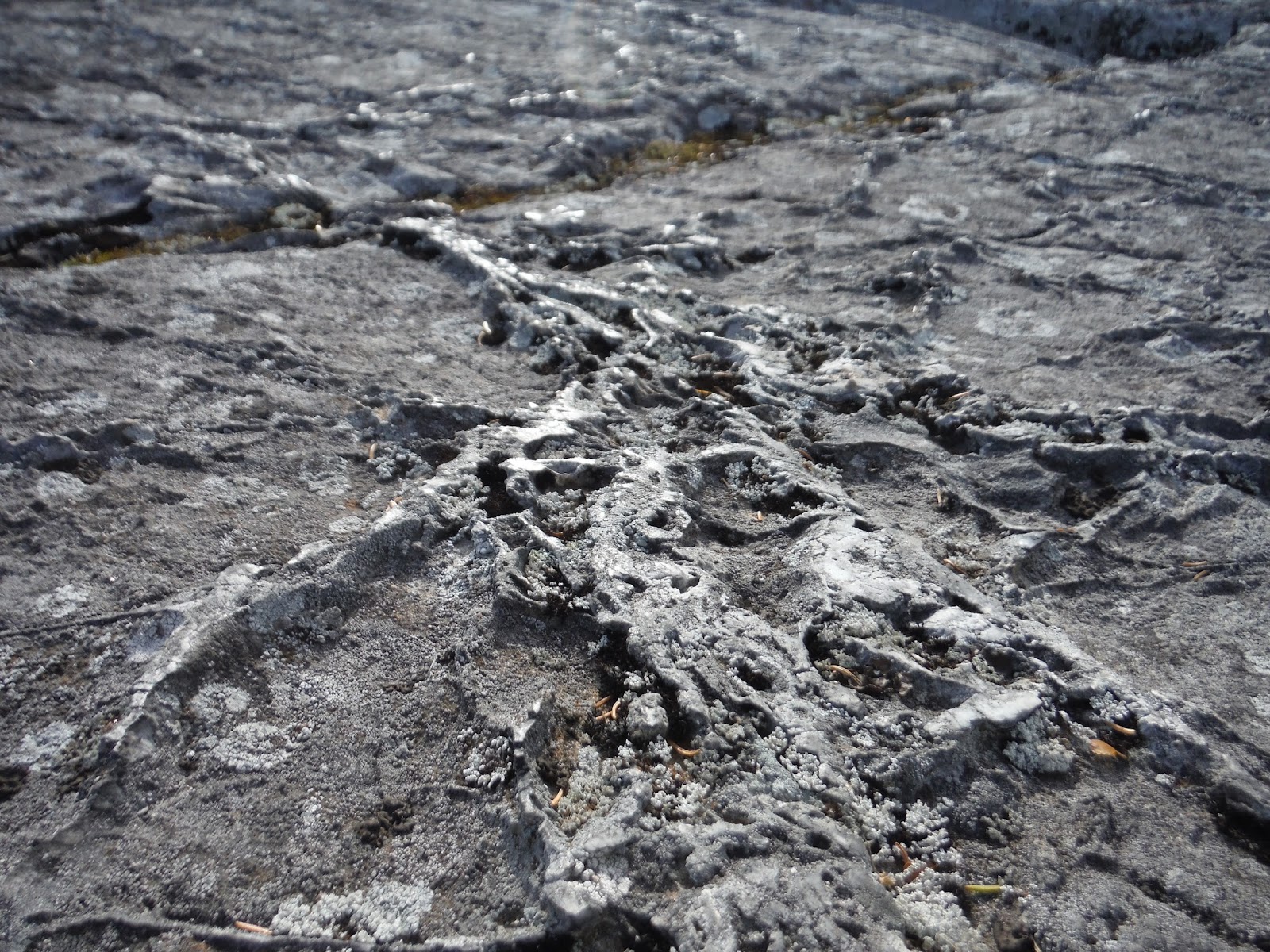 |
| The rocks on the eastern peak |
 |
| The view southwest, Bigelow in the distance |
I saw some really interesting rock patterns on this hike as well. I say they take the medal from Tumbledown's wiggly scrapes from last week. Not sure if this is layered rock that got smushed, or glacier scrapes, but either way, it was pretty awesome. And it adds traction on those steep faces, so you don't get scrapes like this on your face when you fall. :)

Below is my Google Earth track and elevation profile. You can see the trail down to the overlook, which I took on the way up but not on the way down.

Hike Data:
Miles hiked: 3.8
Time elapsed: 2 hours
Total ascent: 1650'
No comments:
Post a Comment