Day 41
5.24
A beautiful morning on the eastern border of Idaho. A good way to start the day. And look - no snow! I think I may be finally entering the territory of summer weather.
 |
| Big Elk Creek CG |
I was heading west on US-20, which passed through what I believe to be potatoes, but it really could have been anything for all I know. It was green - I know that much. Rolling hills, with mountains in the background, very nice to drive through.
I had another difficult choice to make as far as my route goes. I couldn't decide between staying on US-20 or going north on US-93. I ended up going on the northern of the two routes, and this was the better choice, because as you read in the Borah Peak post, this road goes right by.
The mountains started to get snow-capped, and with irrigated green valleys in between, it was quite the view through these parts.
I actually passed by the Borah Peak trailhead, not knowing anything about it, or that it was the tallest mountain in the state for that matter. I saw the sign, and made it probably a mile or two past it, and my gut was telling me to go back and take a look at it. I thought even if it was way too much for a hike, I could at least have my lunch there.
I drove up 3 miles to the foothills of the mountains before me. There was camping, picnicking, and a full service outhouse at this trailhead. Once I read the signs on Borah Peak, and became aware of its grandeur, it was no longer an option in my mind. I had to get up there in some fashion. At first, I said why not do it that day, but then I read that it takes 10-12 hours to complete, and it's a mile of elevation gain in 3.5 miles, I thought it would be better to wait until the next morning, and not rush so much. It was noon, and I didn't want the possibility of coming down at midnight. Not the safest on a first ascent. I listened to the forecast, and the next day, Memorial day, was supposed to be a bit better conditions: partly sunny instead of 50% chance thunderstorms.
With my mind made up, I had the afternoon to kill since I was going to be here until the next day for the hike. As I was making my lunch, I was befriended by a skittish blue bird flitting around. I tried to get a picture of him, but he kept moving, hence the mid-air shot below.
Now I had a great and very unusual idea after having had my lunch...prepare yourselves. I wanted to play the accordion, but not just anywhere - somewhere with good acoustics. The best acoustics for miles was indeed the outhouse. Yes, I played my accordion inside a USFS outhouse. I bet no one has, or ever will do that again in that outhouse, or in any other one for that matter. The resonance in the concrete room was staggering, with a resonant frequency of F natural. So I played the songs I know in F major. Kesh Jig, La Valse des Veiux Os, anything else transposed. I admit I was in there playing for probably 30 minutes. It was so live in there that every time I hit the F chord, my whole body and clothes were vibrating. It was utter joy to the ears.
It was when I exited I realized there was someone else parked at the trailhead. He was getting ready to hike the Borah Peak Trail, but he didn't look like he had enough gear to successfully make a summit (no axe, just poles). Unless his car was really soundproof, or the outhouse was, there is a good chance he heard the music emanating from the outhouse. Some risks are worth taking.
As I was packing up lunch materials, I was startled out of my mind, because that darn bird from before had managed to get inside my car, and flew out as I was putting things in.
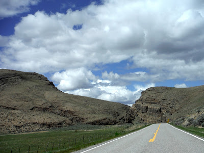
The plan now was to spend the afternoon in Challis, ID, the nearest town, to find some internet and try and learn a bit about Borah Peak. It was 30 miles away, but a beautiful 30 miles it was. Open plains, curvy gorges, hill climbs, cow-land, you name it.
 |
| The big gorge on the way to Challis. |
Going up the road to Borah CG, dark and stormy clouds persisted. I was happy not to be on the trail today. Can't even see the top.
The sun poked through the clouds though, and I was able to make some killer tortellini with pesto under the setting sun. Though with the greenery here came the bugs, so I ate without the mosquitoes inside my car.
 |
| Campsite. I had to back down the access road because I couldn't turn around with my tent set up. |
The route today was again cut short of my expectations, but for a good cause indeed. Miles traveled on day 41: 266. This brings the grand total to 7647.
 |
| Day 41, 266 miles. |


No comments:
Post a Comment